Difference between revisions of "File:CarnerosWatershed Precipitation2.png"
From CCoWS Wiki
| Line 1: | Line 1: | ||
| + | [[Image:CarnerosWatershedPrecipitation2.png|200px|thumb]] | ||
| + | * [[Media:CarnerosWatershed Precipitation1.pdf|PDF file - for printing]] | ||
| + | * [[Media:CarnerosWatershedPrecipitation2.png|PNG file]] | ||
| + | == Metadata == | ||
| + | |||
| + | * Original source of data: See [http://www.prism.oregonstate.edu/docs/meta/ppt_30s_meta.htm PRISM] | ||
| + | * Data anlysis: ArcMap | ||
| + | * Map produced by: Adam J. Purdy | ||
| + | * Coordinate system: UTM Zone 10 | ||
| + | * Datum: NAD 83 | ||
| + | |||
| + | == Processing Steps == | ||
| + | |||
| + | # A --> Raster | ||
| + | # Select the DEM you want to calculate slope from | ||
| + | # Modify colors and category breaks as needed | ||
| + | |||
| + | == Links == | ||
| + | |||
| + | * [[Maps of the Carneros Watershed]] | ||
Revision as of 16:27, 10 February 2011
Metadata
- Original source of data: See PRISM
- Data anlysis: ArcMap
- Map produced by: Adam J. Purdy
- Coordinate system: UTM Zone 10
- Datum: NAD 83
Processing Steps
- A --> Raster
- Select the DEM you want to calculate slope from
- Modify colors and category breaks as needed
Links
File history
Click on a date/time to view the file as it appeared at that time.
| Date/Time | Thumbnail | Dimensions | User | Comment | |
|---|---|---|---|---|---|
| current | 16:26, 10 February 2011 | 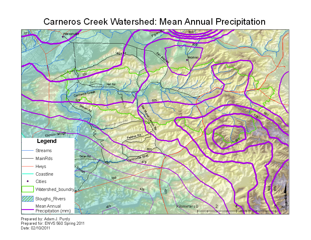 | 1,056 × 816 (759 KB) | Ajp (Talk | contribs) |
- You cannot overwrite this file.
File usage
The following 3 pages link to this file: