Difference between revisions of "File:CarnerosWatershed Precipitation2.png"
From CCoWS Wiki
| Line 1: | Line 1: | ||
| − | + | For metadata and alternate versions, see: [[Carneros Watershed: Precipitation 2]] | |
| − | + | ||
| − | + | ||
| − | + | ||
| − | + | ||
| − | + | ||
| − | + | ||
| − | + | ||
| − | + | ||
| − | + | ||
| − | + | ||
| − | + | ||
| − | + | ||
| − | + | ||
| − | + | ||
| − | + | ||
| − | + | ||
| − | + | ||
| − | + | ||
| − | + | ||
| − | + | ||
Latest revision as of 16:29, 10 February 2011
For metadata and alternate versions, see: Carneros Watershed: Precipitation 2
File history
Click on a date/time to view the file as it appeared at that time.
| Date/Time | Thumbnail | Dimensions | User | Comment | |
|---|---|---|---|---|---|
| current | 16:26, 10 February 2011 | 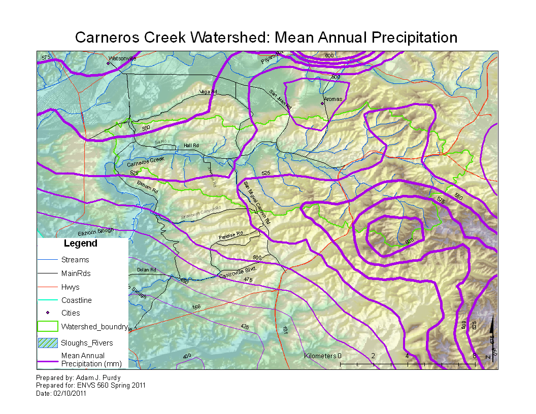 | 1,056 × 816 (759 KB) | Ajp (Talk | contribs) |
- You cannot overwrite this file.
File usage
The following 3 pages link to this file: