Difference between revisions of "Map Of The Lower Salinas River Watershed"
From CCoWS Wiki
| Line 1: | Line 1: | ||
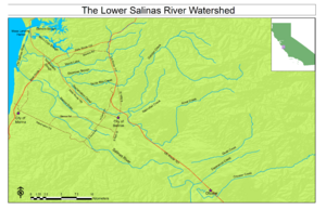
[[Image:Lower Salinas River Watershed.png|300px|thumb|Map Of The Lower Salinas River Watershed]] | [[Image:Lower Salinas River Watershed.png|300px|thumb|Map Of The Lower Salinas River Watershed]] | ||
| − | * [[Image:Lower Salinas River Watershed.pdf | + | * PDF File for Printing: [[Image:Lower Salinas River Watershed.pdf ]] |
| Line 18: | Line 18: | ||
* None | * None | ||
| + | |||
| + | == Licensing == | ||
| + | <a rel="license" href="http://creativecommons.org/licenses/by/3.0/"><img alt="Creative Commons License" style="border-width:0" src="http://i.creativecommons.org/l/by/3.0/80x15.png" /></a><br />This work is licensed under a <a rel="license" href="http://creativecommons.org/licenses/by/3.0/">Creative Commons Attribution 3.0 Unported License</a>. | ||
== Links == | == Links == | ||
Revision as of 14:25, 12 April 2011
- PDF File for Printing: File:Lower Salinas River Watershed.pdf
Contents
Metadata
- Original source of data:
- Hydrography: National Map hydrography data set
- Roads: National Map transportation data set
- Map produced by: Gabriela Alberola
- Map produced using: ArcMap
- Date: April 11 2011
- Coordinate system: Geographic Coordinate System - GCS_North_American_1983
- Datum: D_North_American_1983
Alternate versions
- None
Licensing
<a rel="license" href="http://creativecommons.org/licenses/by/3.0/"><img alt="Creative Commons License" style="border-width:0" src="http://i.creativecommons.org/l/by/3.0/80x15.png" /></a>
This work is licensed under a <a rel="license" href="http://creativecommons.org/licenses/by/3.0/">Creative Commons Attribution 3.0 Unported License</a>.
