Difference between revisions of "Public Land Jurisdictions in the California Central Coast Region"
From CCoWS Wiki
m (SamG moved page Public land jurisdictions in the Central Coast Region to Public Land Jurisdictions in the California Central Coast Region: Title change) |
(→Related Links) |
||
| (4 intermediate revisions by one user not shown) | |||
| Line 1: | Line 1: | ||
| − | Produced by ENVS 560/L Watershed Systems class at CSUMB. | + | Produced by [[ENVS 560/L Watershed Systems]] class at [[CSUMB]]. |
[[File:publiclands.png|850 px|thumb]] | [[File:publiclands.png|850 px|thumb]] | ||
==Summary== | ==Summary== | ||
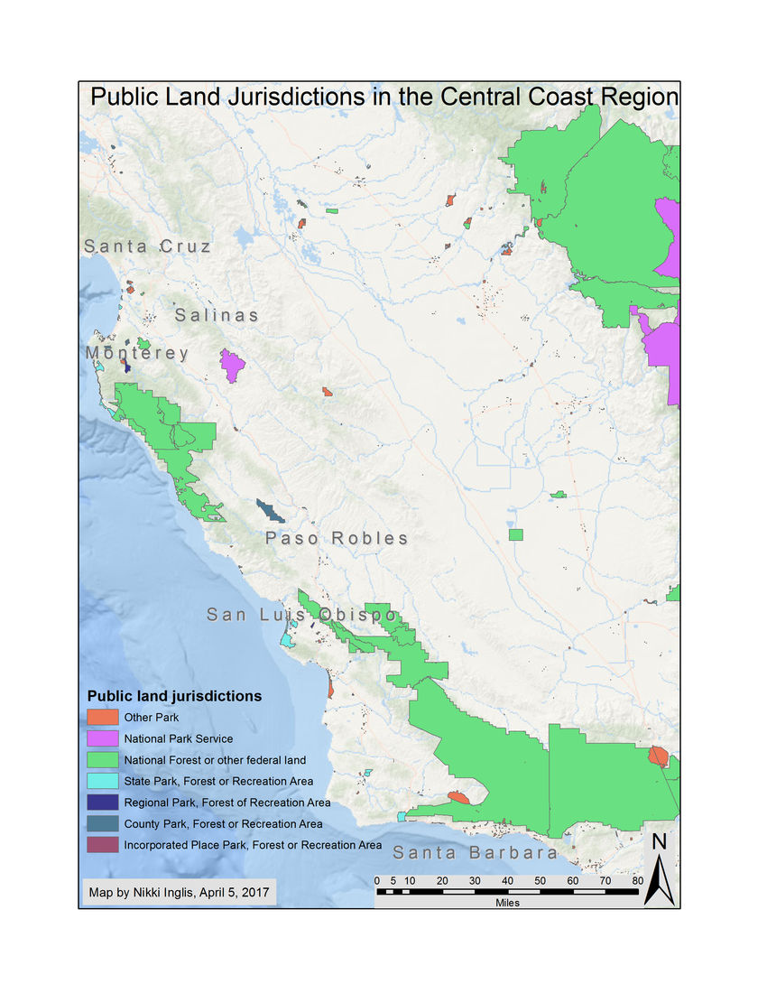
| + | A map showing public land jurisdictions located in [[Santa Cruz County]], [[Monterey County]], [[San Luis Obispo County]], and [[Santa Barbara County]]. | ||
| − | + | ==Related Links== | |
| − | ==Links== | + | *[[United States Forest Service (USFS)]] |
| − | + | *[[National Park Service (NPS)]] | |
| + | *[[California Department of Parks and Recreation]] | ||
| + | *[[BLM]] | ||
| + | *[[Monterey Peninsula Regional Park District (MPRPD)]] | ||
== References == | == References == | ||
Latest revision as of 17:49, 26 February 2021
Produced by ENVS 560/L Watershed Systems class at CSUMB.
Contents
Summary
A map showing public land jurisdictions located in Santa Cruz County, Monterey County, San Luis Obispo County, and Santa Barbara County.
Related Links
- United States Forest Service (USFS)
- National Park Service (NPS)
- California Department of Parks and Recreation
- BLM
- Monterey Peninsula Regional Park District (MPRPD)
References
Disclaimer
This page may contain student work completed as part of assigned coursework. It may not be accurate. It does not necessary reflect the opinion or policy of CSUMB, its staff, or students.
