File list
From CCoWS Wiki
This special page shows all uploaded files.
| Name | Thumbnail | Size | User | Description | Versions | |
|---|---|---|---|---|---|---|
| 13:50, 9 April 2020 | Combined.jpg (file) |  |
470 KB | JamieS | 1 | |
| 20:35, 8 April 2020 | Wikicram.jpg (file) |  |
253 KB | JamieS | 2 | |
| 14:27, 8 April 2020 | WatershedsMBNMS.png (file) |  |
317 KB | LauraF | 1 | |
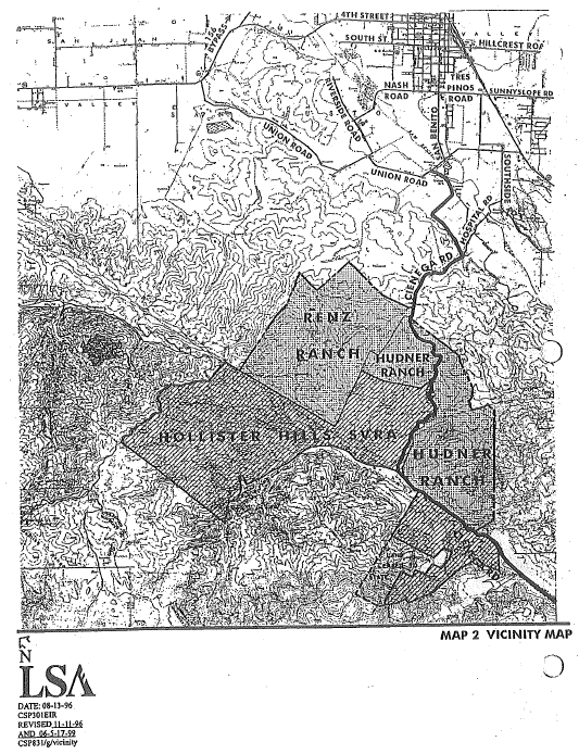
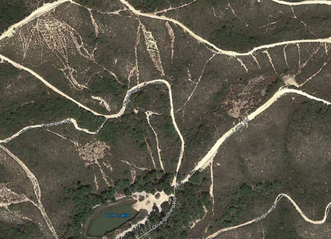
| 12:25, 8 April 2020 | HHSVRA-HR.PNG (file) |  |
168 KB | EricW | Hollister hills SVRA Hunder Renz acquisitions | 1 |
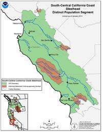
| 12:13, 8 April 2020 | SouthCentralCaliforniaCoastSteelhead.jpg (file) |  |
14 KB | BryanVO | 1 | |
| 12:05, 8 April 2020 | CentralCaliforniaCoastSteelhead.jpg (file) |  |
15 KB | BryanVO | 1 | |
| 11:54, 8 April 2020 | SouthcentralCalcoast steelhead.jpg (file) |  |
14 KB | BryanVO | 1 | |
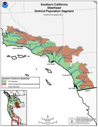
| 09:42, 8 April 2020 | SouthernCalCoastSteelhead noaa.png (file) |  |
1.09 MB | BryanVO | 1 | |
| 21:45, 7 April 2020 | HuberEtAl2014 Page41.png (file) |  |
2.2 MB | JanettePJ | 1 | |
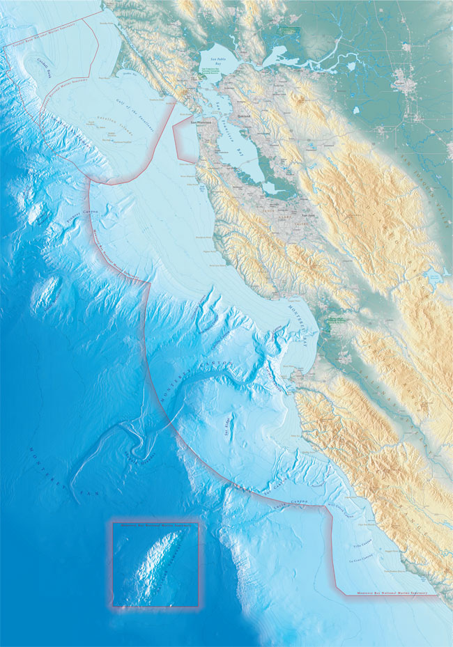
| 13:04, 7 April 2020 | Mbnms lg.jpg (file) |  |
169 KB | RyanS | MBNMS boundaries map | 1 |
| 23:29, 6 April 2020 | Mud.jpg (file) |  |
501 KB | JamieS | 1 | |
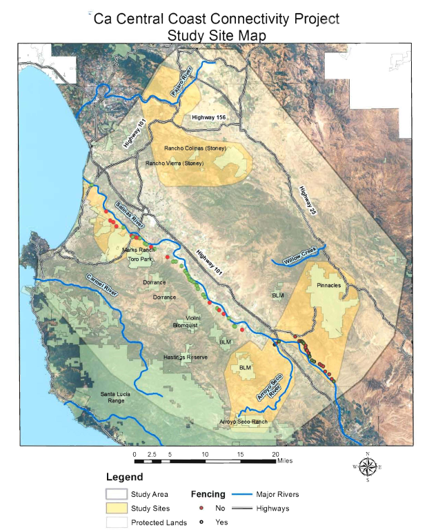
| 21:57, 6 April 2020 | BSLT Pathways Map.jpg (file) |  |
779 KB | MattM | 2 | |
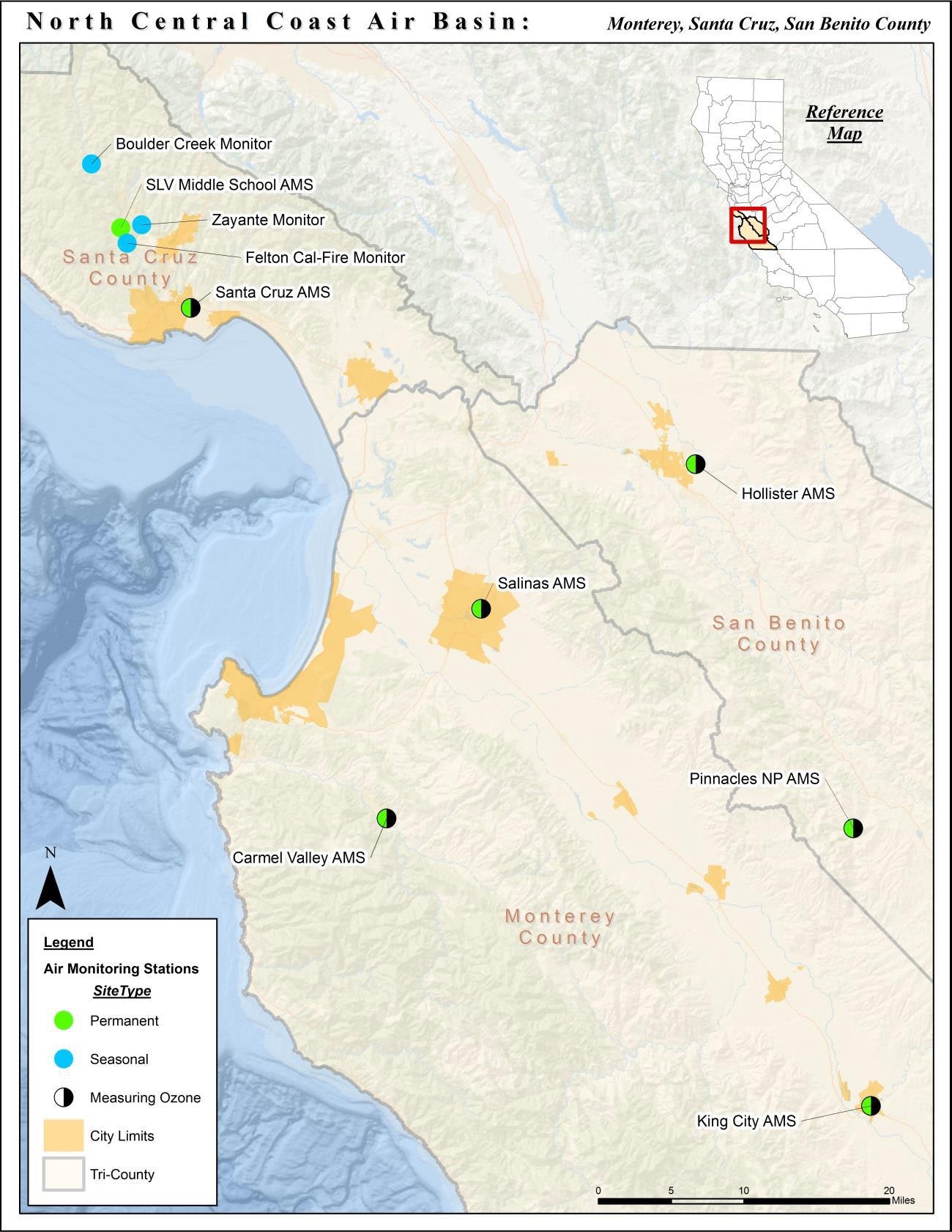
| 21:50, 6 April 2020 | Nccab.jpg (file) |  |
311 KB | EricW | north central coast air basin map | 1 |
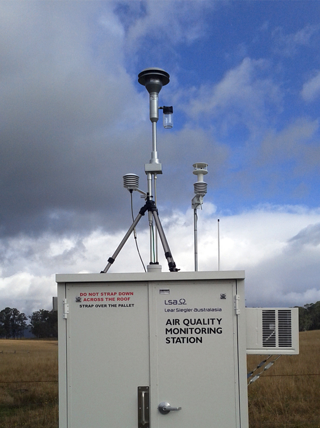
| 21:33, 6 April 2020 | Bayarea monitoring station.jpg (file) |  |
294 KB | EricW | Air Monitoring station in the bay area | 1 |
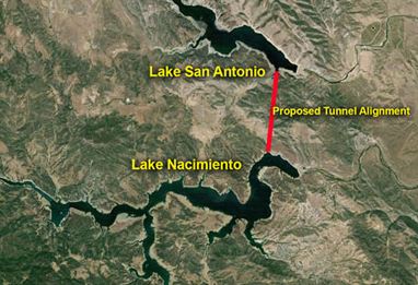
| 21:31, 6 April 2020 | InterLakeTunnel.JPG (file) |  |
23 KB | TedR | 1 | |
| 21:27, 6 April 2020 | Mbard logo.png (file) | 1.39 MB | EricW | 3 | ||
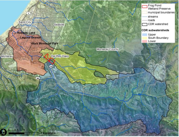
| 20:41, 6 April 2020 | SubwatershedCDR.JPG (file) |  |
109 KB | RyanB | 1 | |
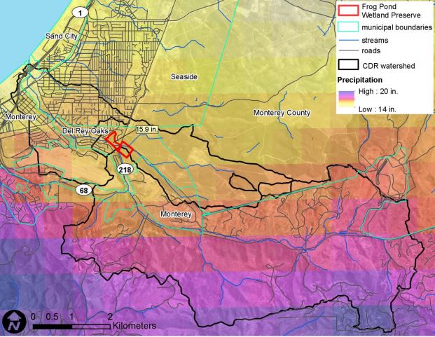
| 20:21, 6 April 2020 | CanyondelReyWatershedBoundary.JPG (file) |  |
85 KB | RyanB | 1 | |
| 20:03, 6 April 2020 | CTSFortOrd.jpg (file) |  |
2.76 MB | LauraF | 1 | |
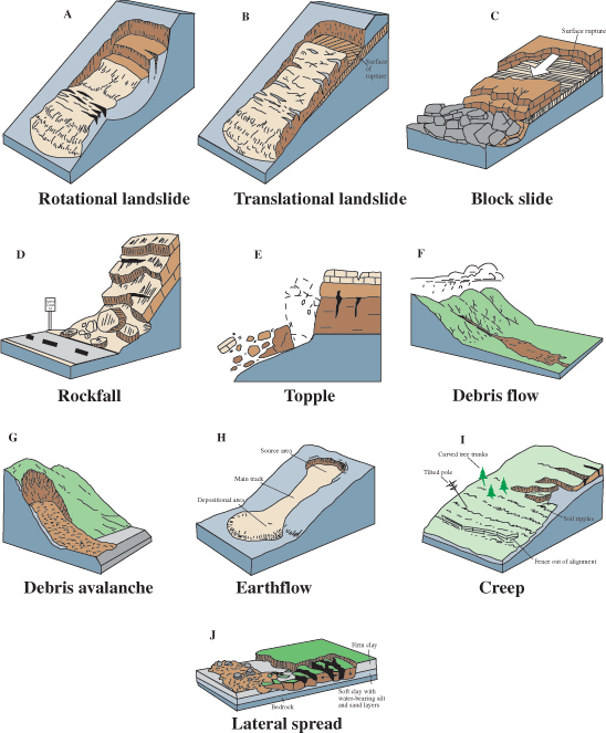
| 19:31, 6 April 2020 | Landslides.jpg (file) |  |
192 KB | JamieS | 1 | |
| 02:43, 6 April 2020 | SalinasRiver.JPG (file) |  |
182 KB | DanL | 1 | |
| 22:35, 5 April 2020 | RobertsLake.jpg (file) |  |
14 KB | RyanB | 1 | |
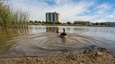
| 01:31, 5 April 2020 | Laguna Grande Lake.jpg (file) |  |
24 KB | RyanB | Laguna Grande Lake | 1 |
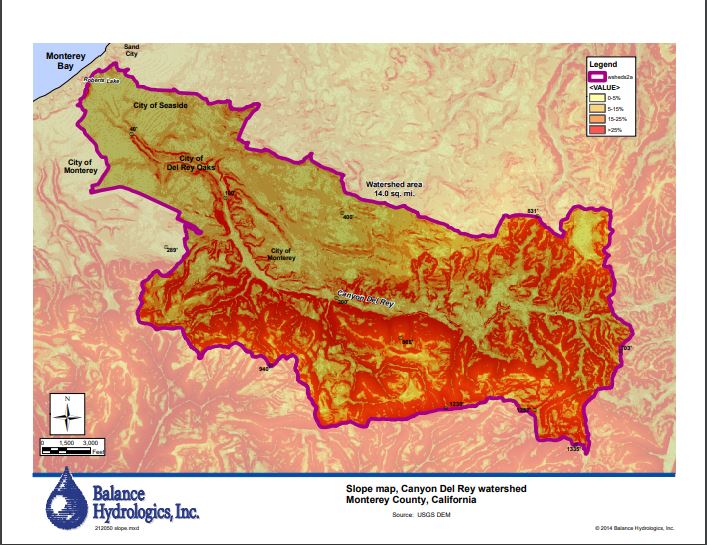
| 00:23, 5 April 2020 | CanyondelReySlopeMap.JPG (file) |  |
95 KB | RyanB | A slope map of the Canyon del Rey Watershed created by Balance Hydrologics Inc and included in the 2014 Canyon del Rey Master Drainage Plan prepared for the Monterey Peninsula Water Management District. | 2 |
| 16:03, 4 April 2020 | WNS2019.JPG (file) |  |
1.99 MB | JanettePJ | 1 | |
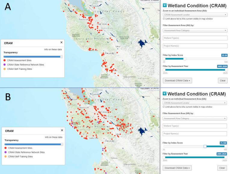
| 17:48, 2 April 2020 | CRAMlogo.png (file) |  |
57 KB | LianaS | 1 | |
| 02:25, 31 March 2020 | Nitrate Blanco.JPG (file) |  |
34 KB | RyanB | 1 | |
| 02:03, 31 March 2020 | OrthophosphateBlancoTimeSeries.JPG (file) |  |
31 KB | RyanB | 1 | |
| 01:33, 31 March 2020 | Unionized Blanco Drain Time Series.JPG (file) |  |
30 KB | RyanB | 1 | |
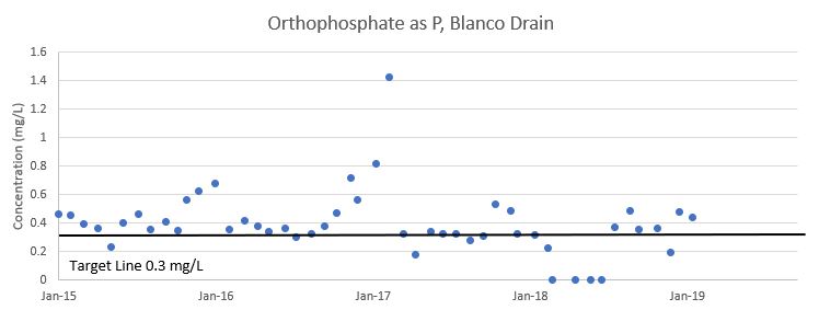
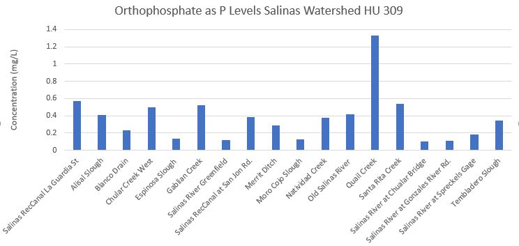
| 00:20, 31 March 2020 | Orthophosphate.JPG (file) |  |
40 KB | RyanB | Orthophosphate as P | 1 |
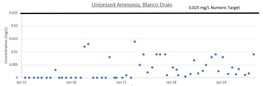
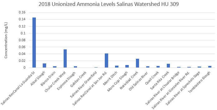
| 23:59, 30 March 2020 | UnionizedAm.JPG (file) |  |
39 KB | RyanB | Monitoring Data Unionized Ammonia | 1 |
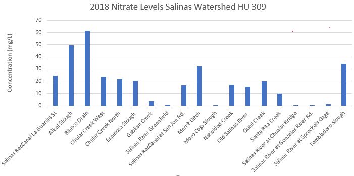
| 23:01, 30 March 2020 | Nitrate.JPG (file) |  |
39 KB | RyanB | A graph of 2018 nitrate data within the Salinas Watershed | 1 |
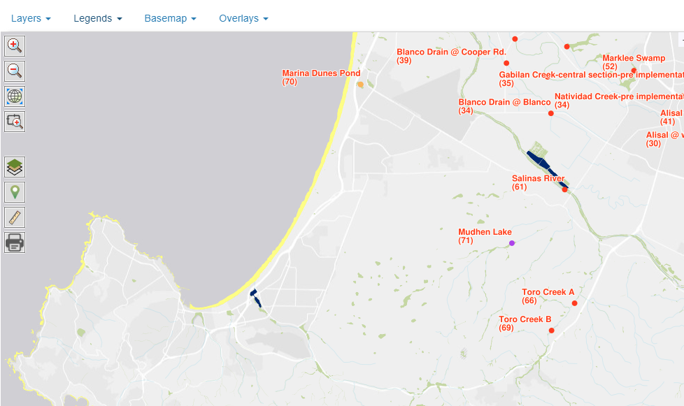
| 15:08, 30 March 2020 | CRAM.png (file) |  |
2.28 MB | LianaS | CRAM flowchart | 1 |
| 14:31, 29 March 2020 | HHErosion.JPG (file) |  |
220 KB | MikaelaB | 1 | |
| 11:23, 28 March 2020 | HHSVRAMap.JPG (file) |  |
85 KB | MikaelaB | 1 | |
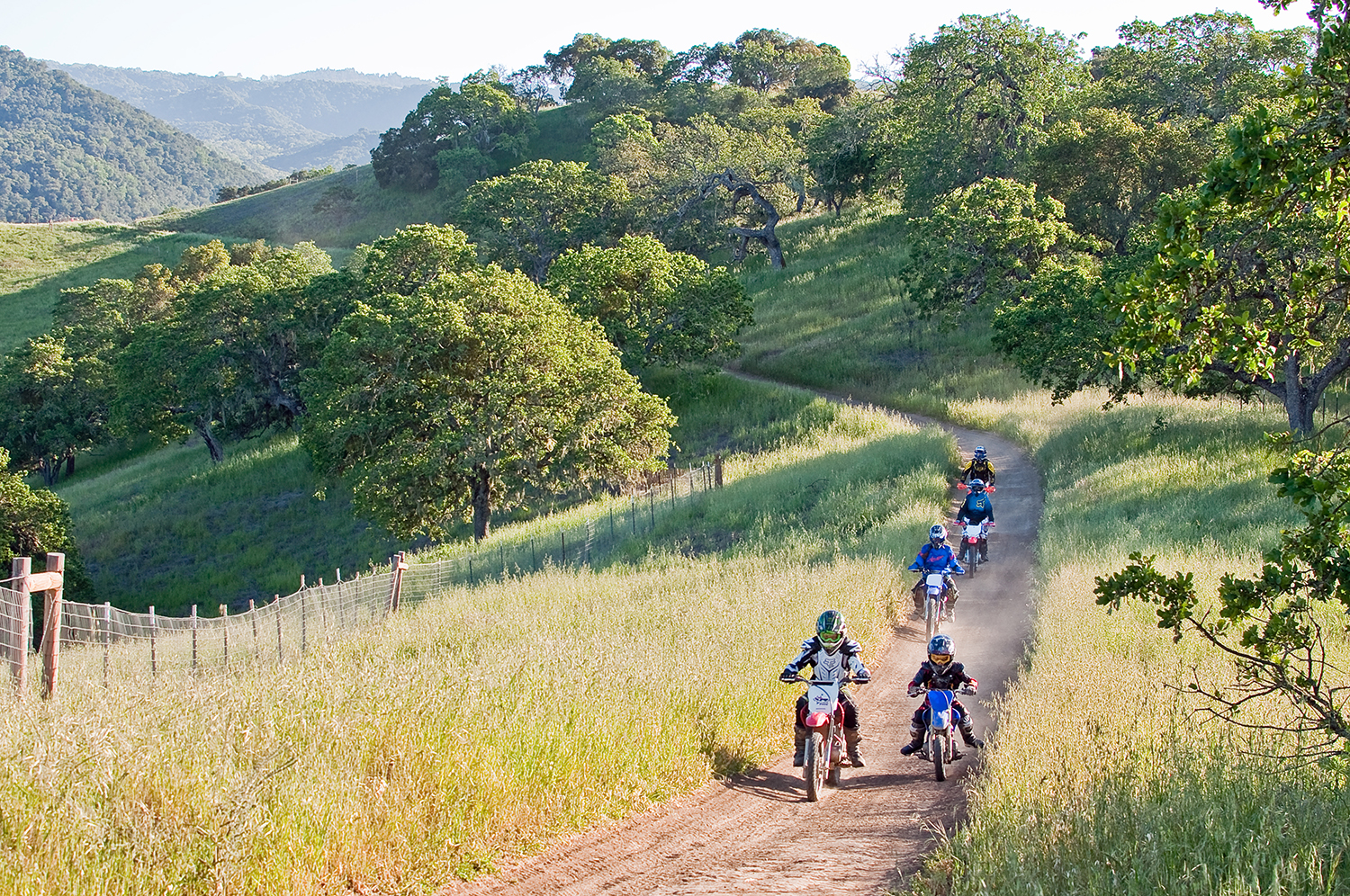
| 10:37, 28 March 2020 | Hollisterhillssvre.JPG (file) |  |
2.26 MB | MikaelaB | 1 | |
| 13:50, 26 March 2020 | InterlakeTunnel.JPG (file) |  |
37 KB | TedR | 1 | |
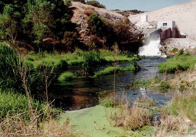
| 13:43, 26 March 2020 | SanAntonioDam.JPG (file) |  |
44 KB | TedR | 1 | |
| 11:52, 26 March 2020 | NacimientoDam.JPG (file) |  |
31 KB | TedR | 1 | |
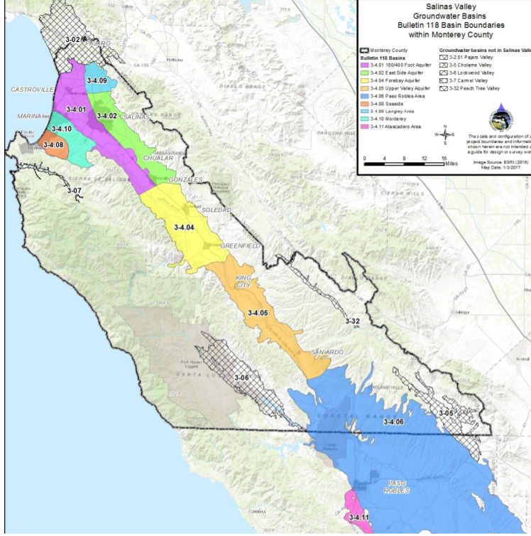
| 11:33, 4 April 2019 | Salinas Valley Groundwater Basins.png (file) |  |
855 KB | MichaelG | 1 | |
| 19:14, 3 April 2019 | CASGEM BasinPrioritization Statewide.jpg (file) |  |
567 KB | MichaelG | SGMA aquifer categories | 1 |
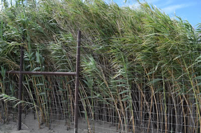
| 09:47, 2 April 2019 | Arundo-donax-sm.jpg (file) |  |
43 KB | StefanieK | Arundo donax along the Salinas River. Photo from https://www.rcdmonterey.org/salinas-river-arundo-and-tamarisk-control | 1 |
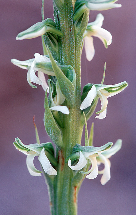
| 17:04, 1 April 2019 | YadonsPiperia.jpeg (file) |  |
94 KB | JohnW | Yadon's piperia (Piperia yadonii) | 1 |
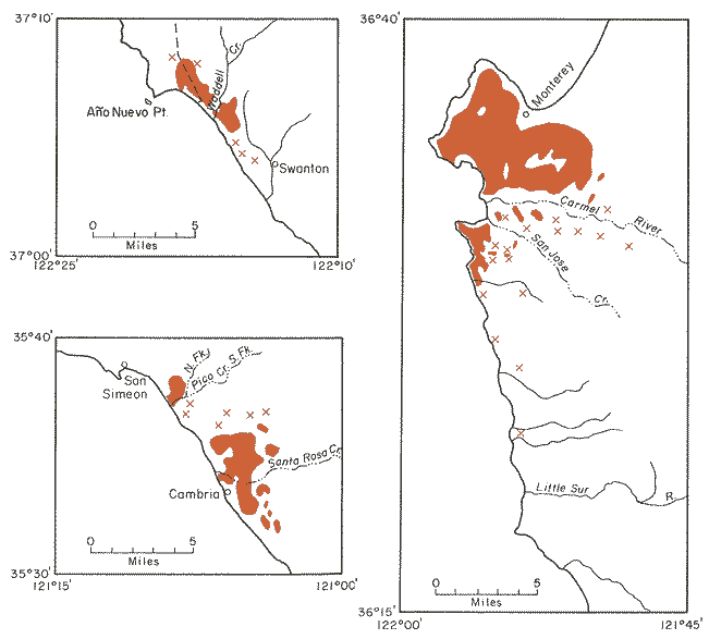
| 13:31, 29 March 2019 | MontereyPineMap.gif (file) |  |
14 KB | JohnW | Reference: https://www.conifers.org/pi/Pinus_radiata.php | 1 |
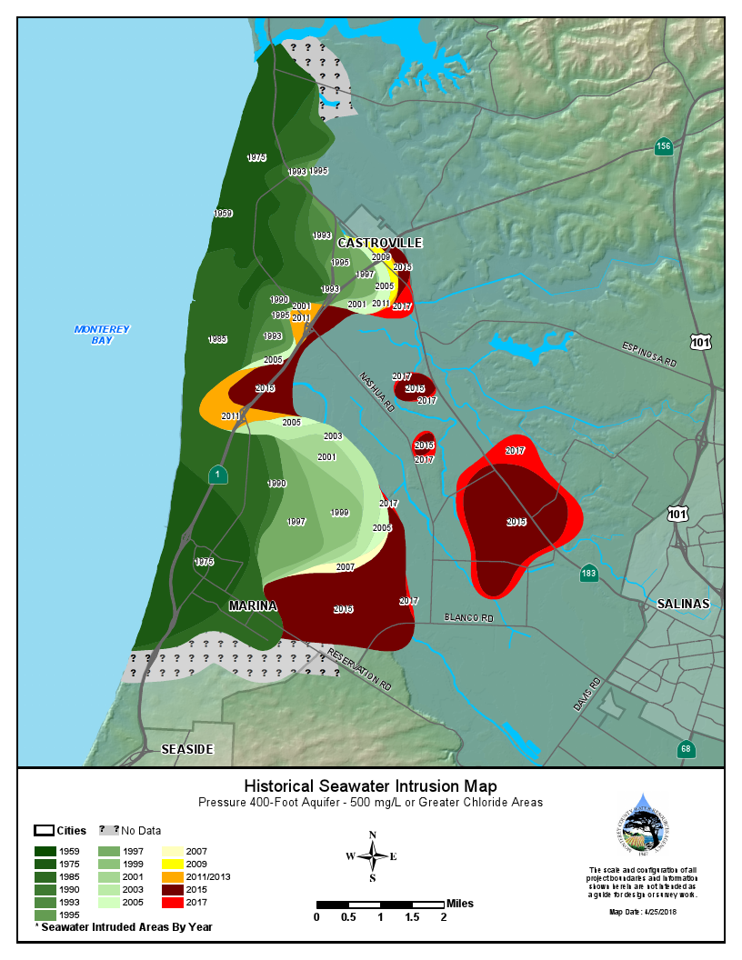
| 13:18, 29 March 2019 | 2018HistoricSeawaterInstrusionMap400ftAquifer.png (file) |  |
544 KB | StefanieK | 1 | |
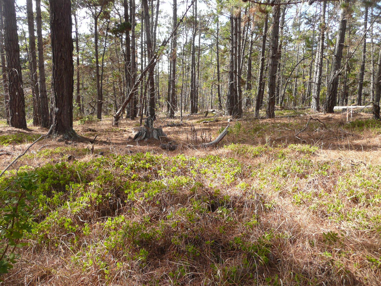
| 13:18, 29 March 2019 | Pine forest Ahookeri JW.JPG (file) |  |
923 KB | JohnW | Monterey pine forest understory with Arctostaphylos hookeri ssp. hookeri. Photo by John Wandke | 1 |
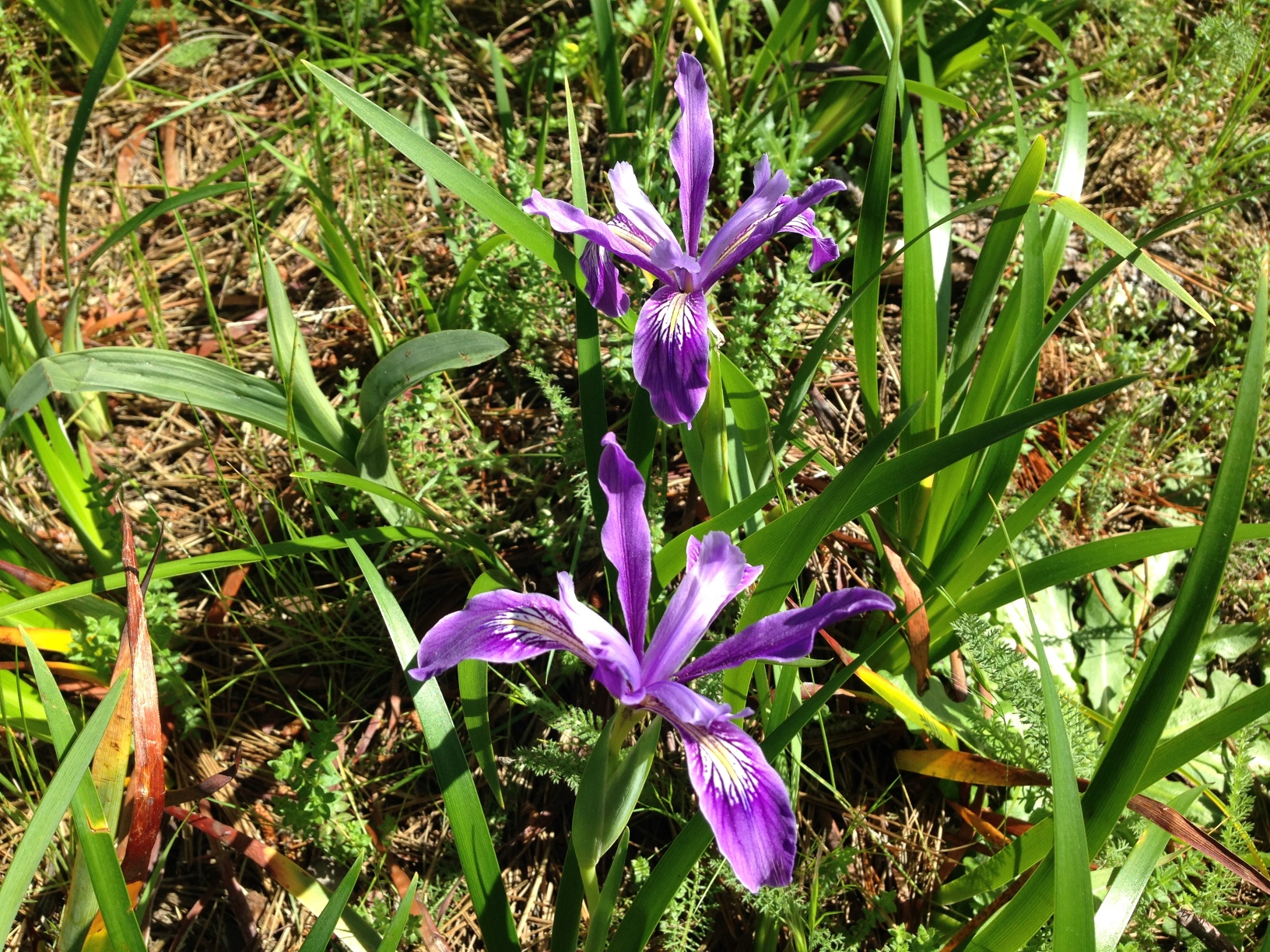
| 13:16, 29 March 2019 | Douglas iris JW.JPG (file) |  |
1.12 MB | JohnW | Douglas iris. Photo by John Wandke, Del Monte Forest, CA | 1 |
| 13:15, 29 March 2019 | 2018HistoricSeawaterInstrusionMap180ftAquifer.pdf (file) | 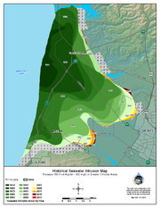 |
503 KB | StefanieK | Reverted to version as of 20:14, 29 March 2019 | 5 |
| 13:03, 29 March 2019 | 2018HistoricSeawaterInstrusionMap180ftAquifer.png (file) |  |
600 KB | StefanieK | Reverted to version as of 22:18, 28 March 2019 | 5 |
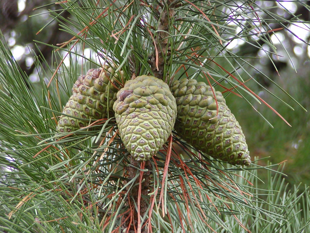
| 13:13, 28 March 2019 | Radiata11.jpg (file) |  |
288 KB | JohnW | 1 |
First page |
Previous page |
Next page |
Last page |