File list
From CCoWS Wiki
This special page shows all uploaded files.
| Name | Thumbnail | Size | User | Description | Versions | |
|---|---|---|---|---|---|---|
| 10:37, 6 February 2011 | CarnerosWatershed Basemap.pdf (file) | 241 KB | Fred | 1 | ||
| 08:48, 7 February 2011 | Elkhorn Slough Watersheds.jpg (file) |  |
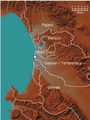
91 KB | Rogera | Map of watersheds surrounding the Elkhorn Slough estuary (map adapted from CSUMB 2007). The white dot on the map indicates the area where Salinas River waters intermittently enter the Old Salinas River Channel and Elkhorn Slough. Copied from: [http://www | 1 |
| 14:29, 8 February 2011 | Pajaro Valley Basemap.jpg (file) |  |
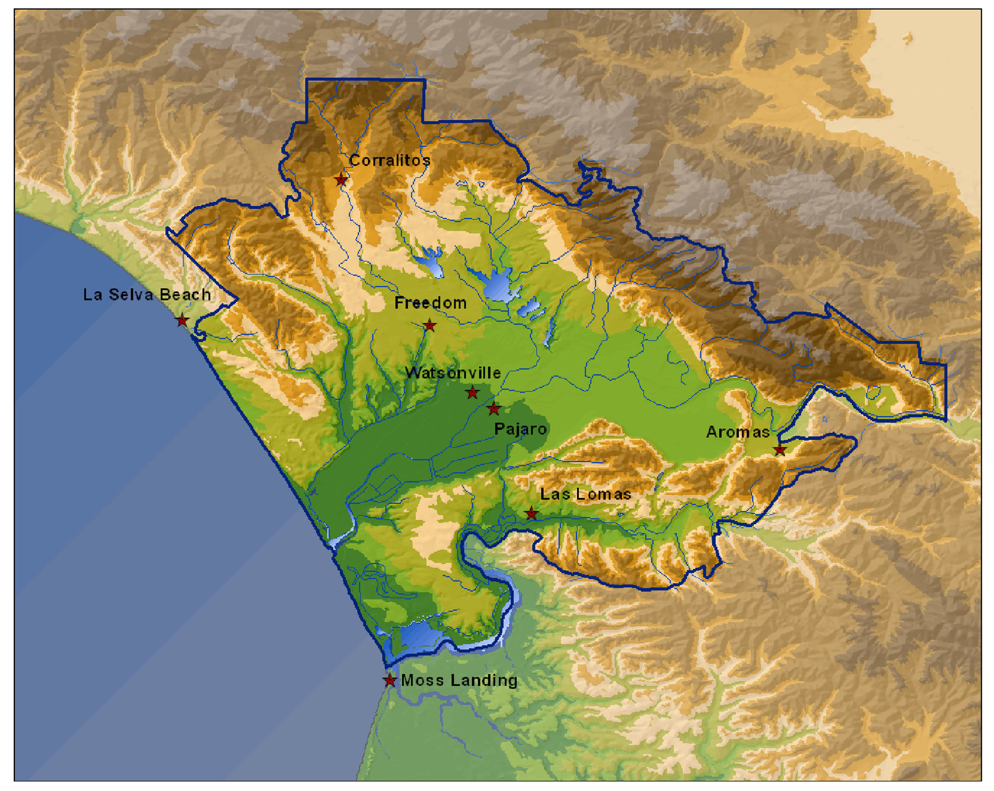
569 KB | Rogera | Overview of Pajaro Valley boundaries. Copied from [http://www.pvwma.dst.ca.us/# PVWMA] | 1 |
| 16:49, 8 February 2011 | Carneros Watershed Aerial NAIP.png (file) |  |
1.91 MB | Jakes | 1 | |
| 17:24, 8 February 2011 | Carneros Watershed Aerial NAIP.pdf (file) | 7.91 MB | Jakes | 1 | ||
| 17:31, 8 February 2011 | Carneros slope stonerkyle.pdf.pdf (file) | 1.68 MB | Kyles | 1 | ||
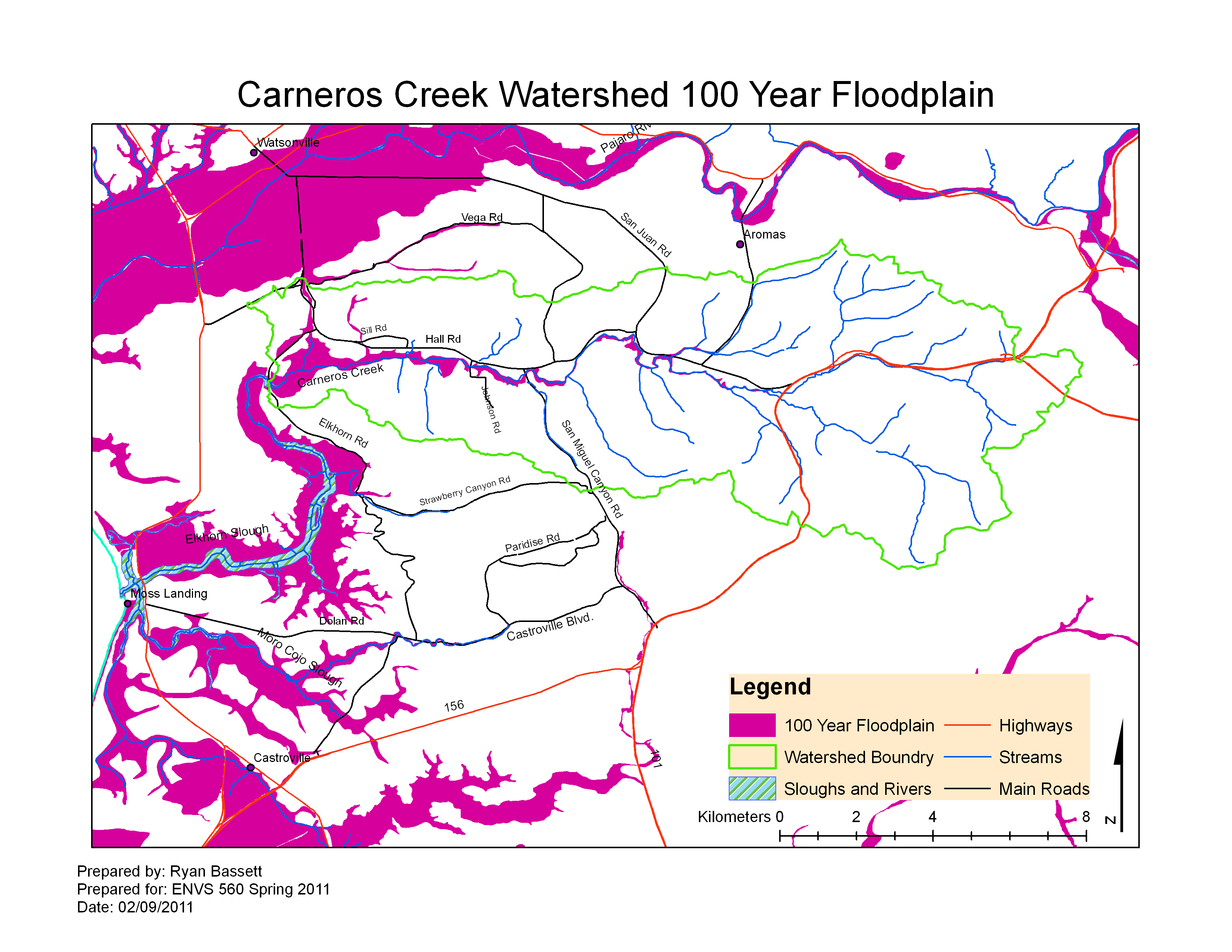
| 16:24, 9 February 2011 | CarnerosWatershed 100yrFloodplain.pdf (file) | 380 KB | Ryanb | 3 | ||
| 16:24, 9 February 2011 | CarnerosWatershed 100yrFloodplain.png (file) |  |
341 KB | Ryanb | 2 | |
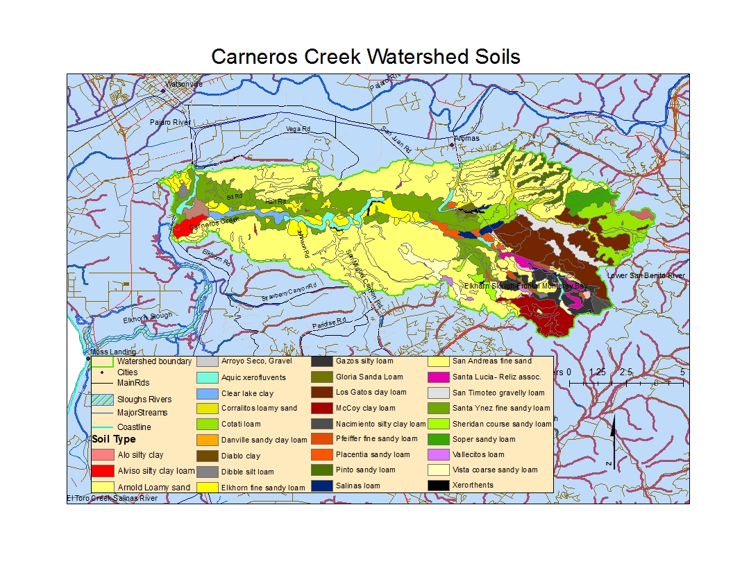
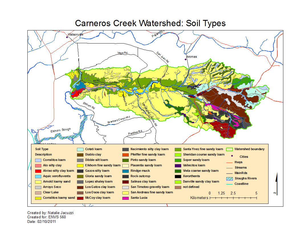
| 00:26, 10 February 2011 | Image-CarnerosSoil.jpg (file) |  |
715 KB | Nataliej | Map of the soils in the Carneros Watershed | 1 |
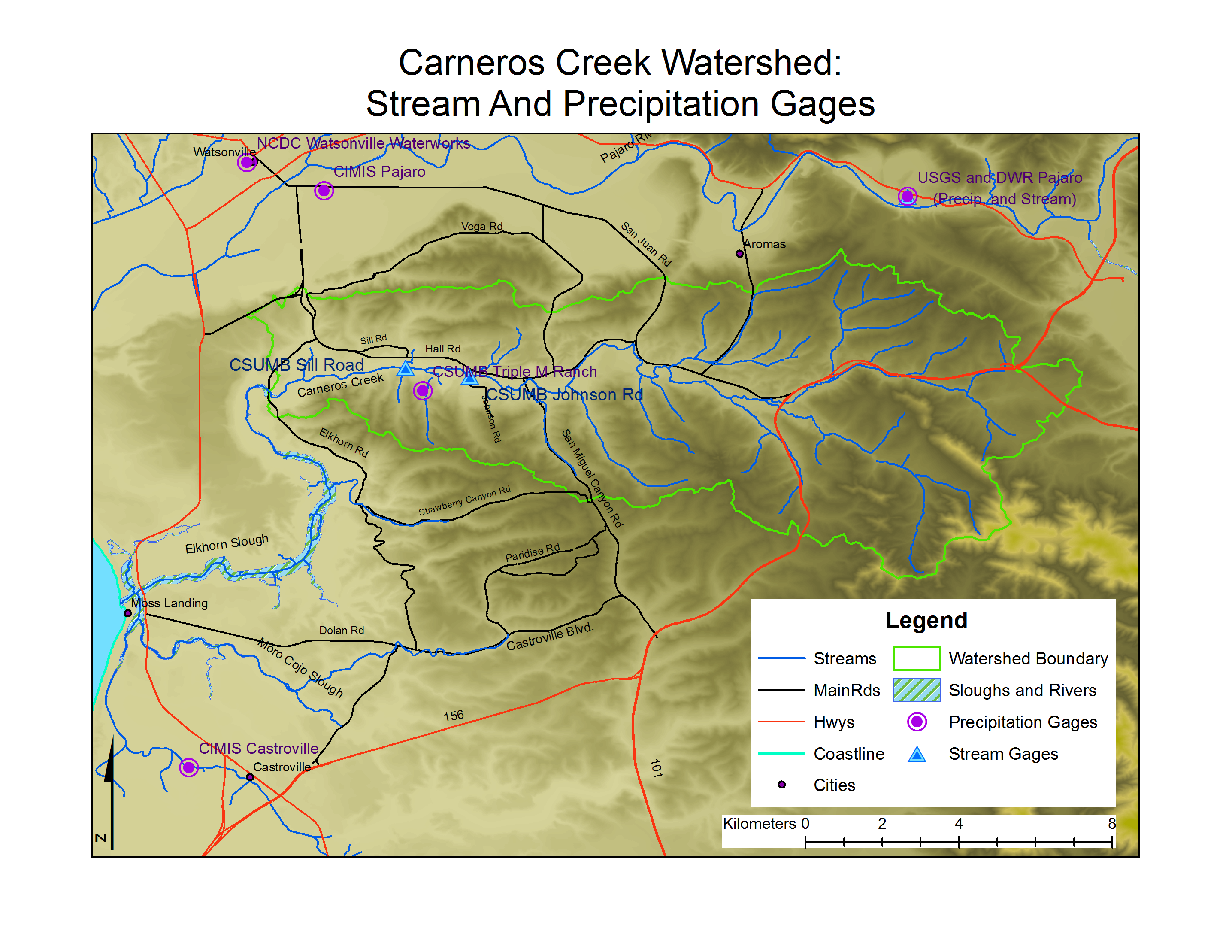
| 12:51, 10 February 2011 | CarnerosWatershed Precip Stream Gages.pdf (file) | 1.67 MB | Gabrielaa | 1 | ||
| 12:54, 10 February 2011 | CarnerosWatershed Precip Stream Gages.png (file) |  |
1.35 MB | Gabrielaa | 1 | |
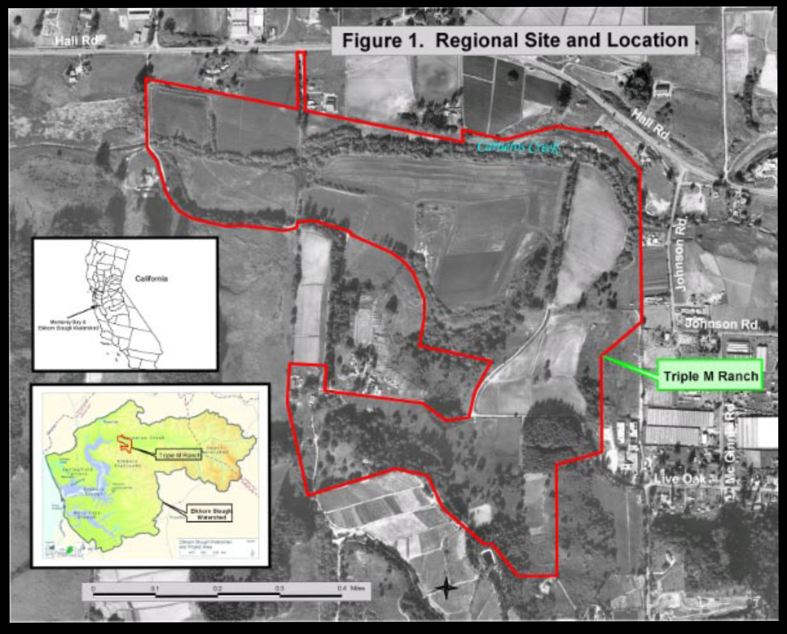
| 14:49, 10 February 2011 | TripleMMap Laurel.jpg (file) |  |
806 KB | Ryanb | 1 | |
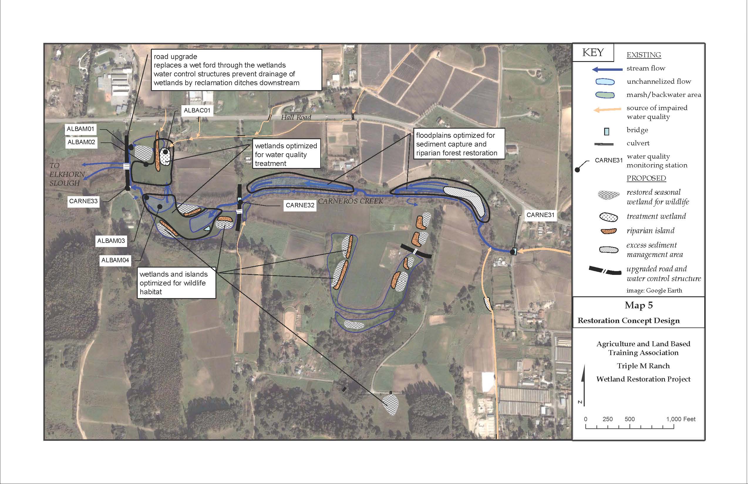
| 14:59, 10 February 2011 | Restoration map.jpg (file) |  |
342 KB | Ryanb | 1 | |
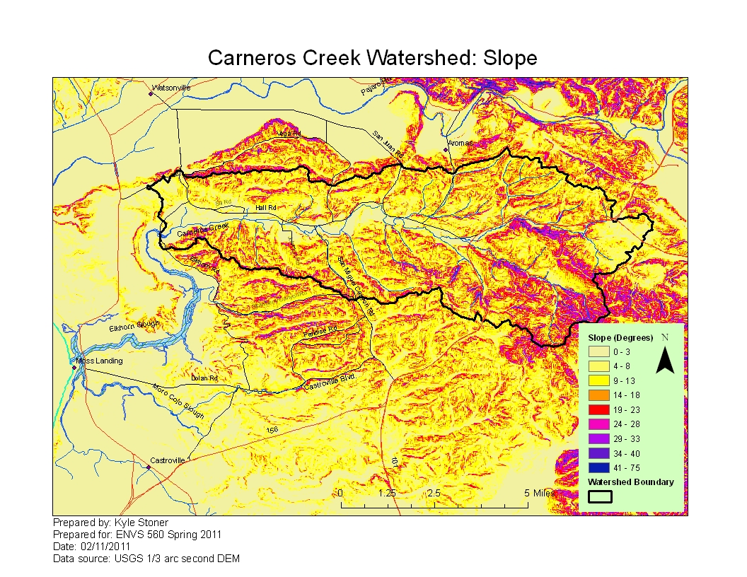
| 15:30, 10 February 2011 | Carneros slope stonerkyle.pdf (file) | 1.67 MB | Kyles | 4 | ||
| 15:30, 10 February 2011 | Carneros slope.jpg (file) |  |
858 KB | Kyles | 4 | |
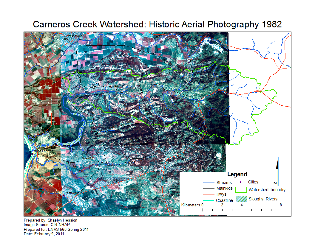
| 15:41, 10 February 2011 | Carneros1982.png (file) |  |
1,010 KB | Shaelynh | 6 | |
| 15:59, 10 February 2011 | Carneros1982.pdf (file) | 1.09 MB | Shaelynh | 1 | ||
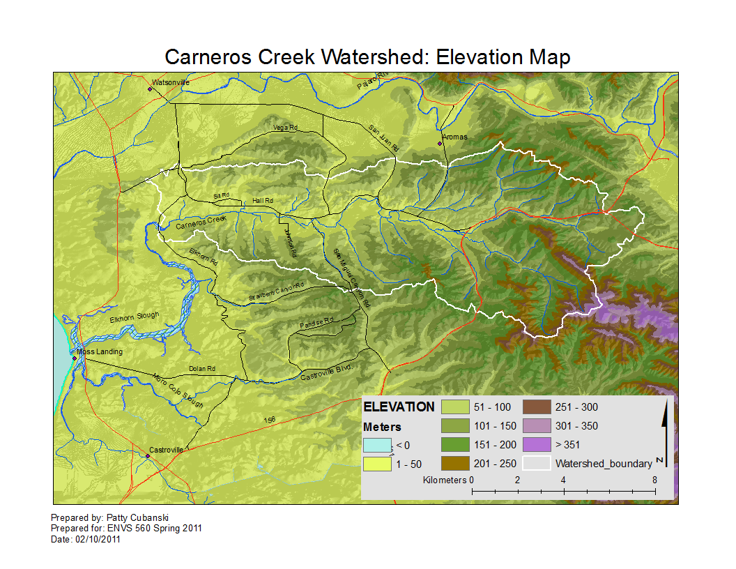
| 16:05, 10 February 2011 | CarnerosWatershed ElevationMap.pdf (file) | 4.24 MB | Pattyc | 5 | ||
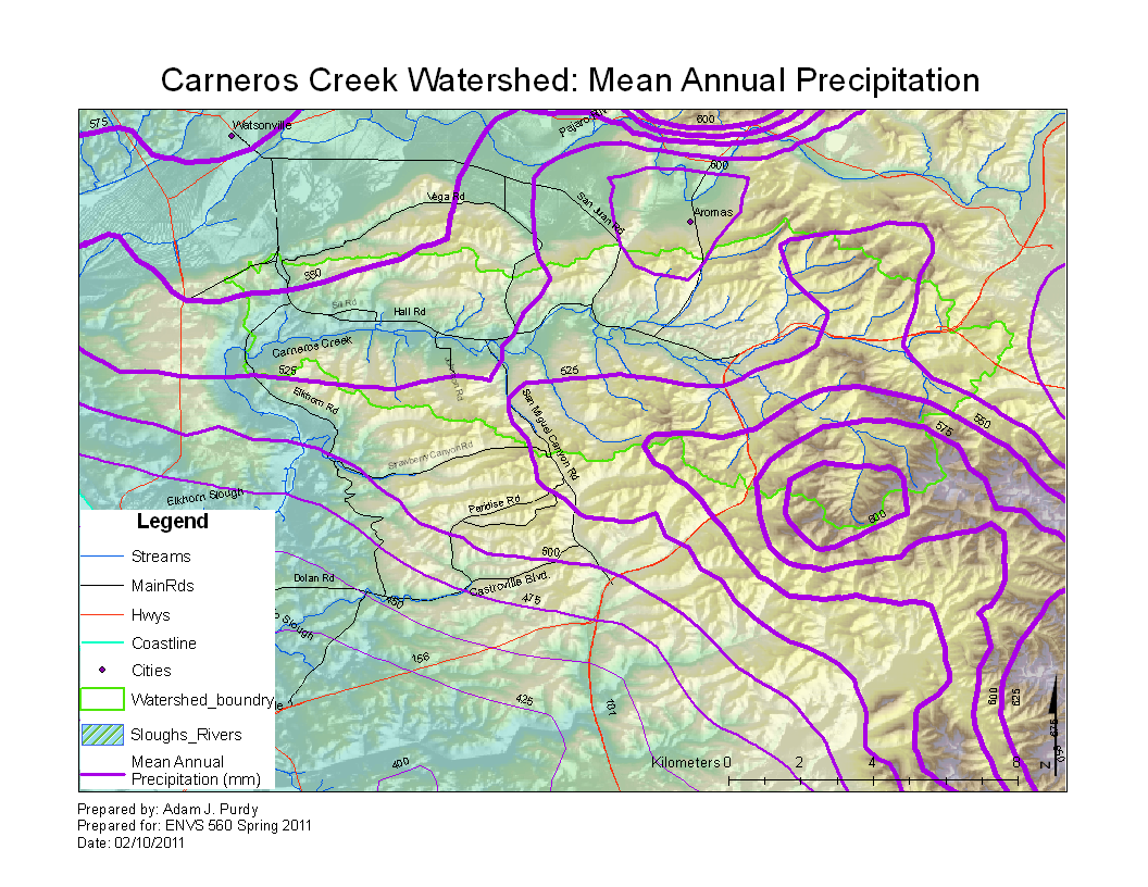
| 16:07, 10 February 2011 | CarnerosWatershed Precipitation1.pdf (file) | 258 KB | Ajp | 1 | ||
| 16:08, 10 February 2011 | CarnerosWatershed ElevationMap.png (file) |  |
567 KB | Pattyc | Reverted to version as of 23:05, 10 February 2011 | 5 |
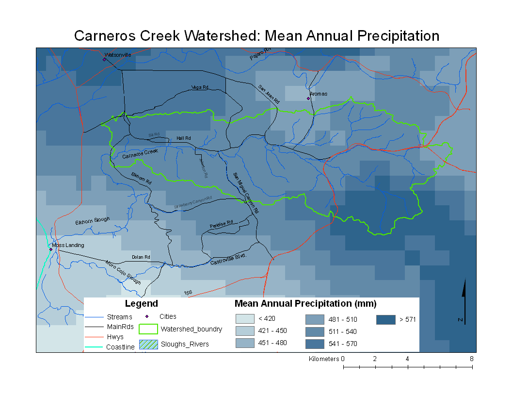
| 16:09, 10 February 2011 | CarnerosWatershedPrecipitation1.png (file) |  |
46 KB | Ajp | 1 | |
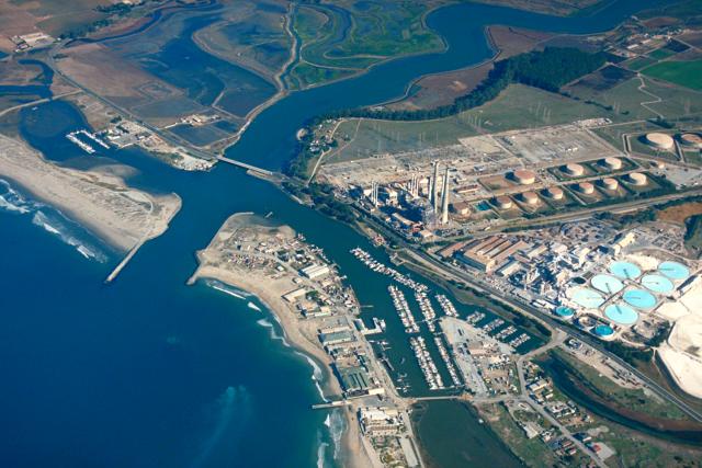
| 16:17, 10 February 2011 | Moss Landing Harbor.jpg (file) |  |
57 KB | Rogera | Ariel view of Moss Landing Harbor with Elkhorn Slough in the background. Copied from [https://eportal.usace.army.mil/sites/DVL/DVL%20Images/Forms/DispForm.aspx?ID=2573 USACE Digital Visual Library] | 1 |
| 16:26, 10 February 2011 | CarnerosWatershed Precipitation2.png (file) |  |
759 KB | Ajp | 1 | |
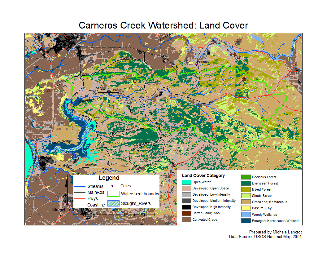
| 16:40, 10 February 2011 | CarnerosWatershed LandCover.pdf (file) | 221 KB | Gabrielaa | 1 | ||
| 16:44, 10 February 2011 | Elkhorn.png (file) |  |
211 KB | Rosea | 1 | |
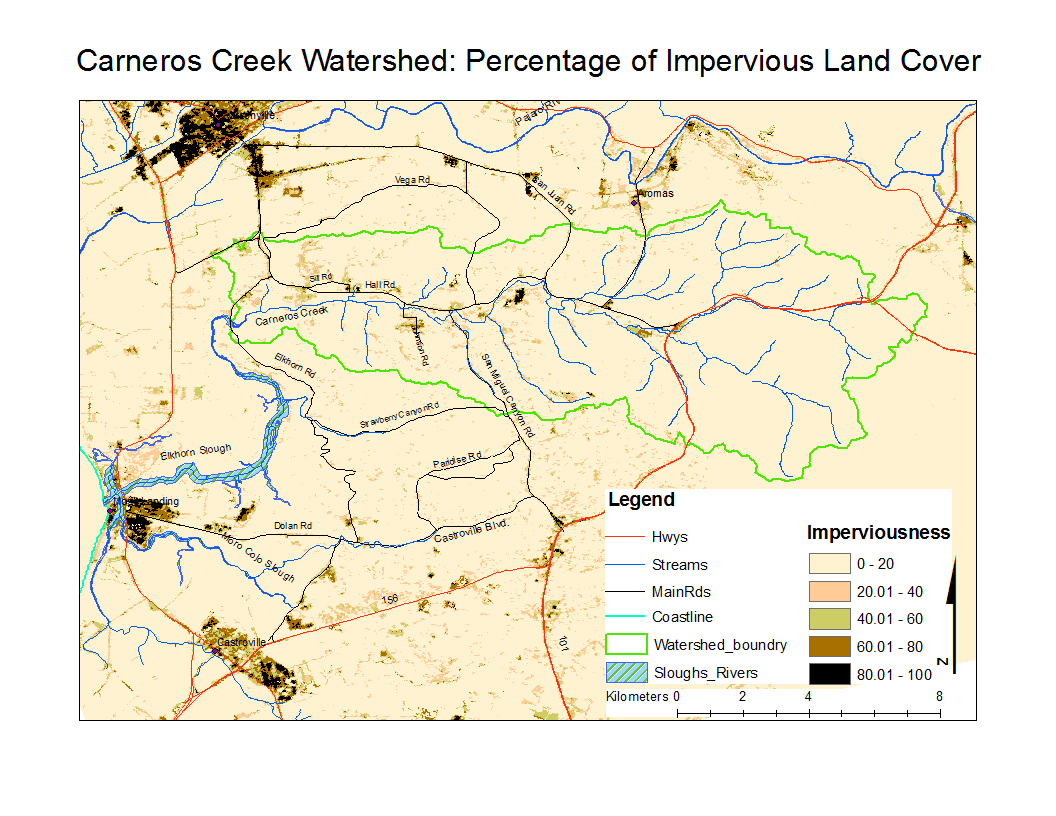
| 16:44, 10 February 2011 | CarnerosWatershed Impervious.png (file) |  |
126 KB | Michelel | 1 | |
| 16:45, 10 February 2011 | CarnerosWatershed Precipitation2.pdf (file) | 231 KB | Ajp | 1 | ||
| 16:48, 10 February 2011 | CarnerosSoil.jpg (file) |  |
521 KB | Nataliej | Carneros Watershed Soil Types | 4 |
| 16:49, 10 February 2011 | CarnerosSoil.png (file) |  |
93 KB | Nataliej | Carneros Watershed Soil Types | 3 |
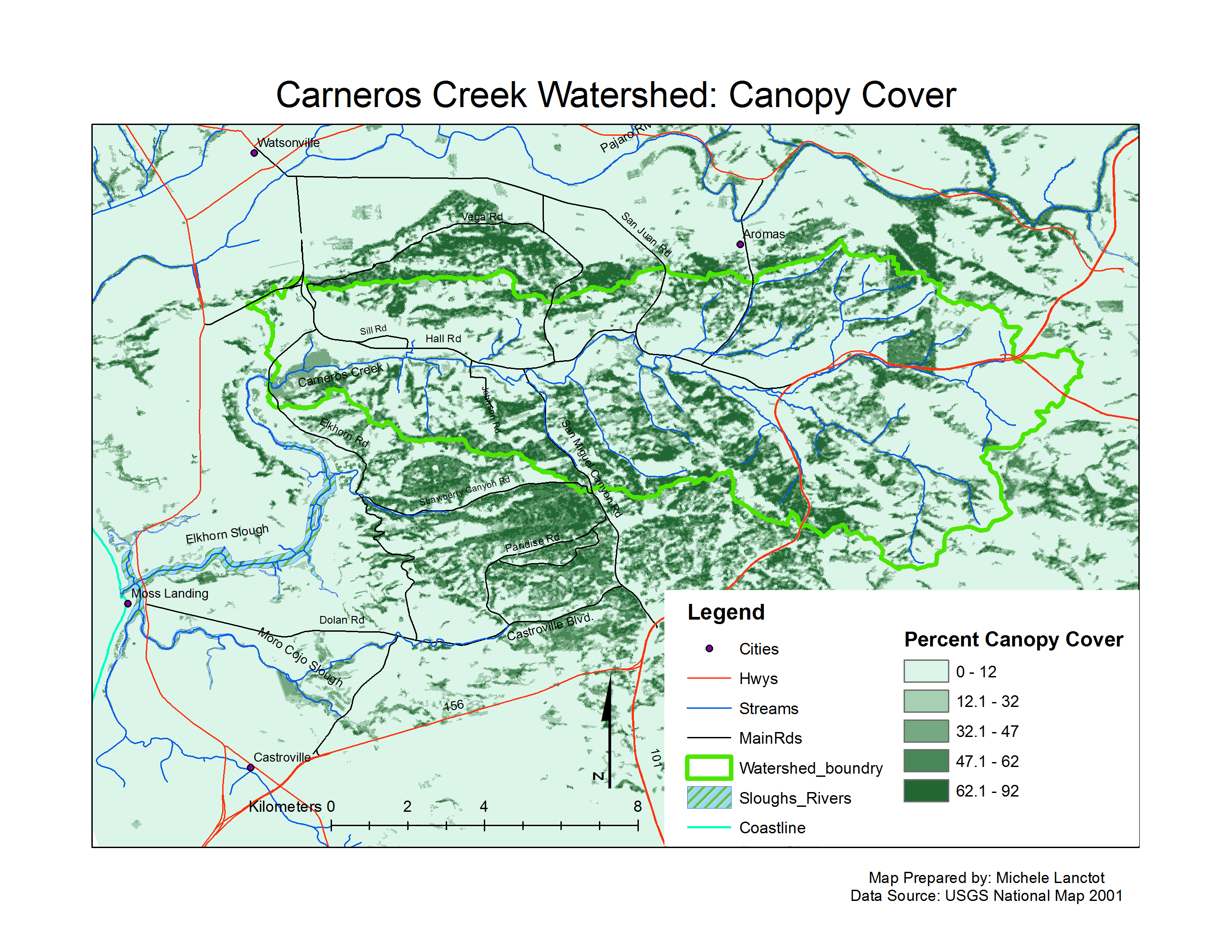
| 00:04, 12 February 2011 | CarnerosWatershed Canopy.png (file) |  |
586 KB | Michelel | 1 | |
| 00:19, 12 February 2011 | CarnerosWatershed canopy.pdf (file) | 208 KB | Michelel | 1 | ||
| 08:19, 12 February 2011 | CarnerosWatershed Landcover.png (file) |  |
224 KB | Gabrielaa | 1 | |
| 17:56, 12 February 2011 | CarnerosSoil.pdf (file) | 471 KB | Nataliej | Carneros Watershed Soil Types | 1 | |
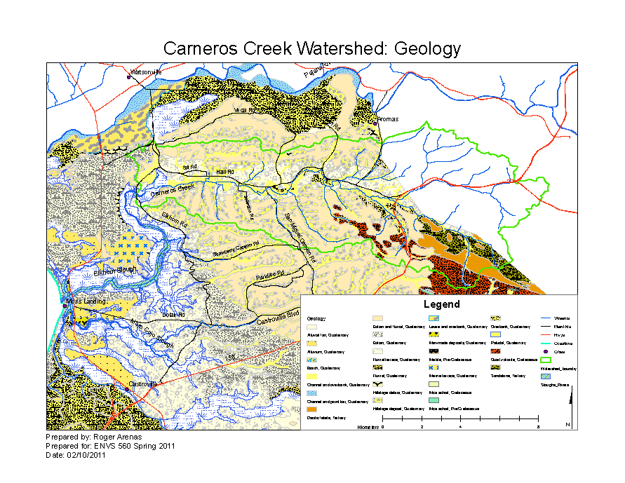
| 16:45, 15 February 2011 | CarnerosWatershed Geology.pdf (file) | 3.05 MB | Rogera | 3 | ||
| 16:46, 15 February 2011 | CarnerosBaselineGeology.png (file) |  |
123 KB | Rogera | 4 | |
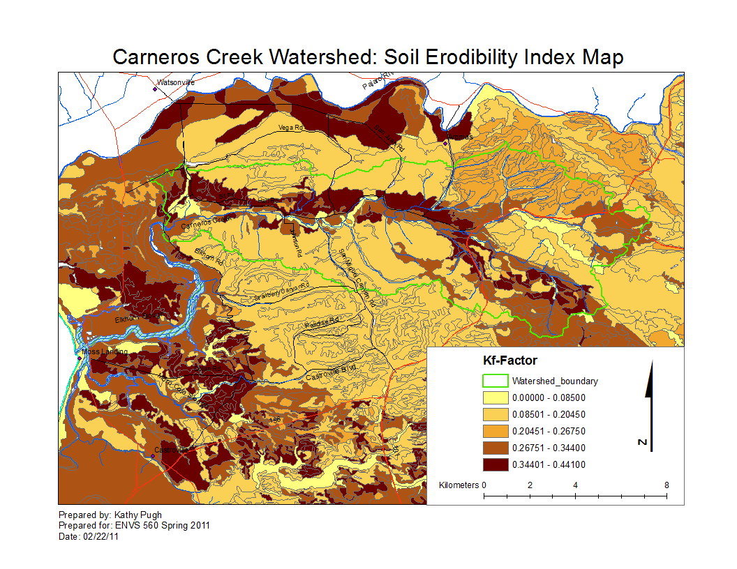
| 10:40, 24 February 2011 | CarnerosWatershed SoilsKfFactor.png (file) |  |
147 KB | Kathyp | 1 | |
| 10:40, 24 February 2011 | CarnerosWatershed SoilsKfFactor.pdf (file) | 1.06 MB | Kathyp | 1 | ||
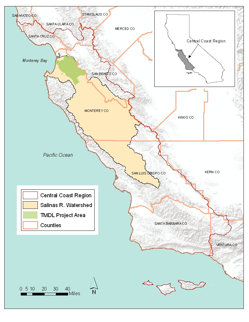
| 21:28, 31 March 2011 | TMDL Project Area.png (file) |  |
554 KB | Rosea | diazinon and chlorpyrifos TMDL project area | 1 |
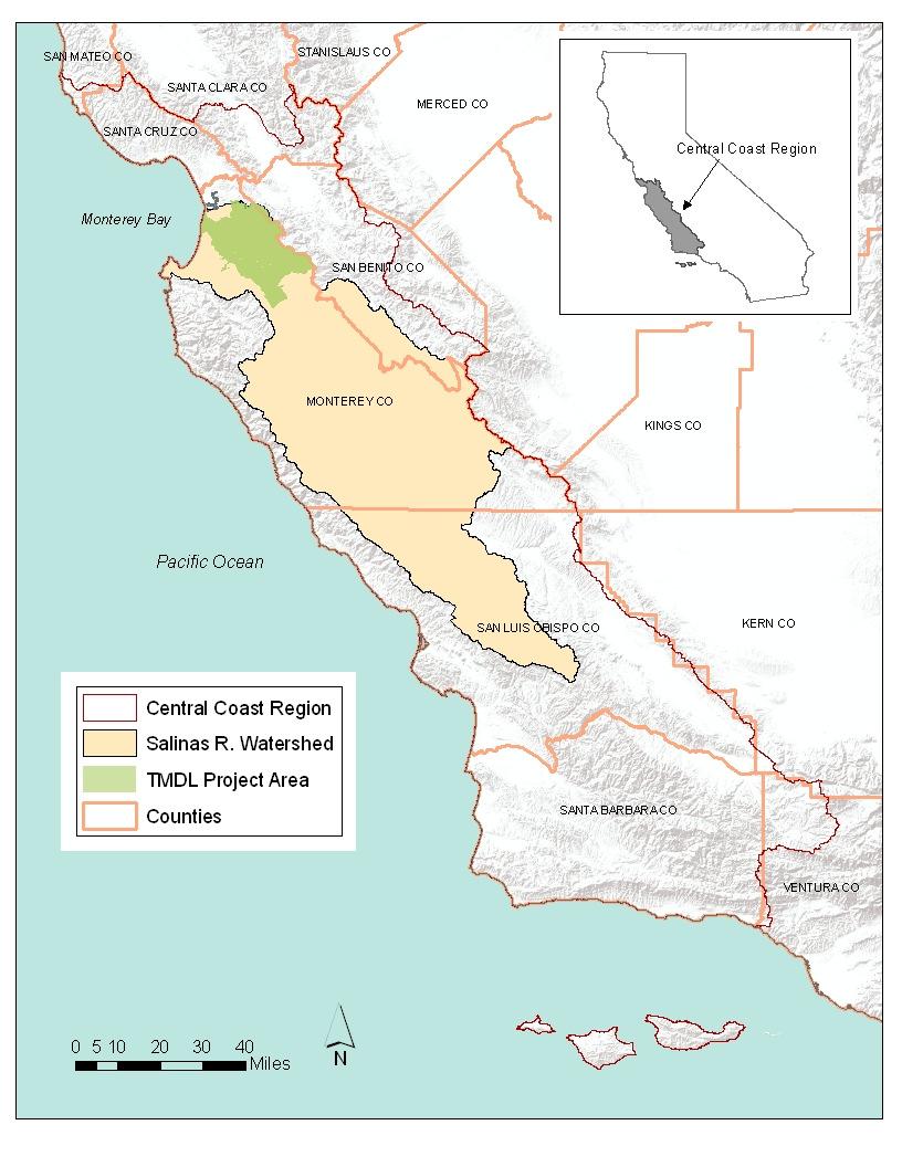
| 21:39, 31 March 2011 | Project Area TMDL.jpg (file) |  |
114 KB | Rosea | diazinon and chlorpyrifos | 1 |
| 12:27, 3 April 2011 | Agwaiver.png (file) |  |
135 KB | Rosea | 2 | |
| 16:46, 7 April 2011 | 2003 - Santa Clara River Nitrogen TMDL.pdf (file) | 725 KB | Rogera | EPA Approved Santa Clara River Nitrogen TMDL | 1 | |
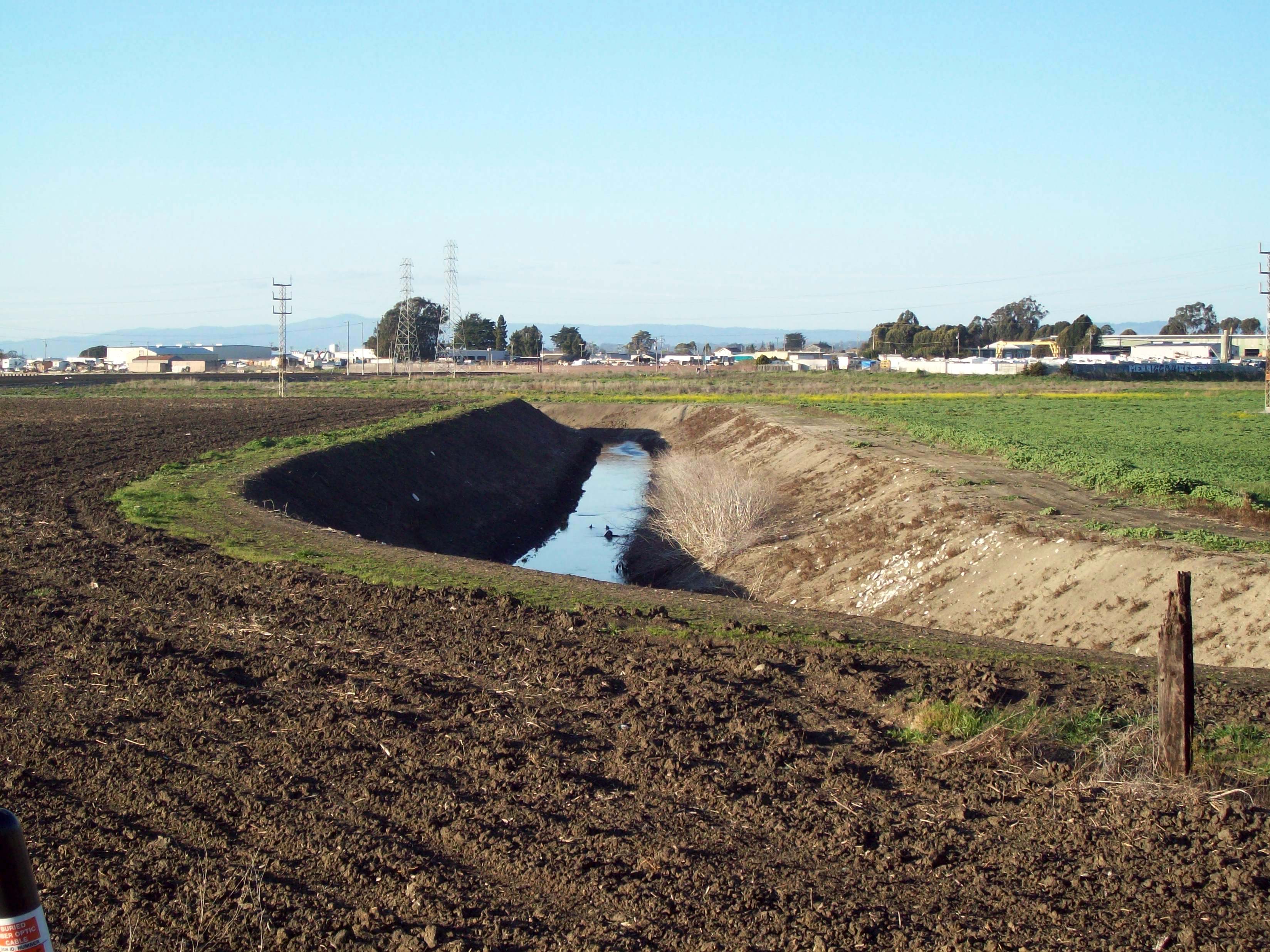
| 11:30, 8 April 2011 | Agwaiver.jpg (file) |  |
74 KB | Rosea | Picture Reclamation Ditch looking upstream from San Jon Rd.(Photo: Don Kozlowski, June 2002). Copied from [http://ccows.csumb.edu/pubs/reports/CCoWS_DPR_FinalReport_040331c.pdf CCoWS DPR Final Report]. | 4 |
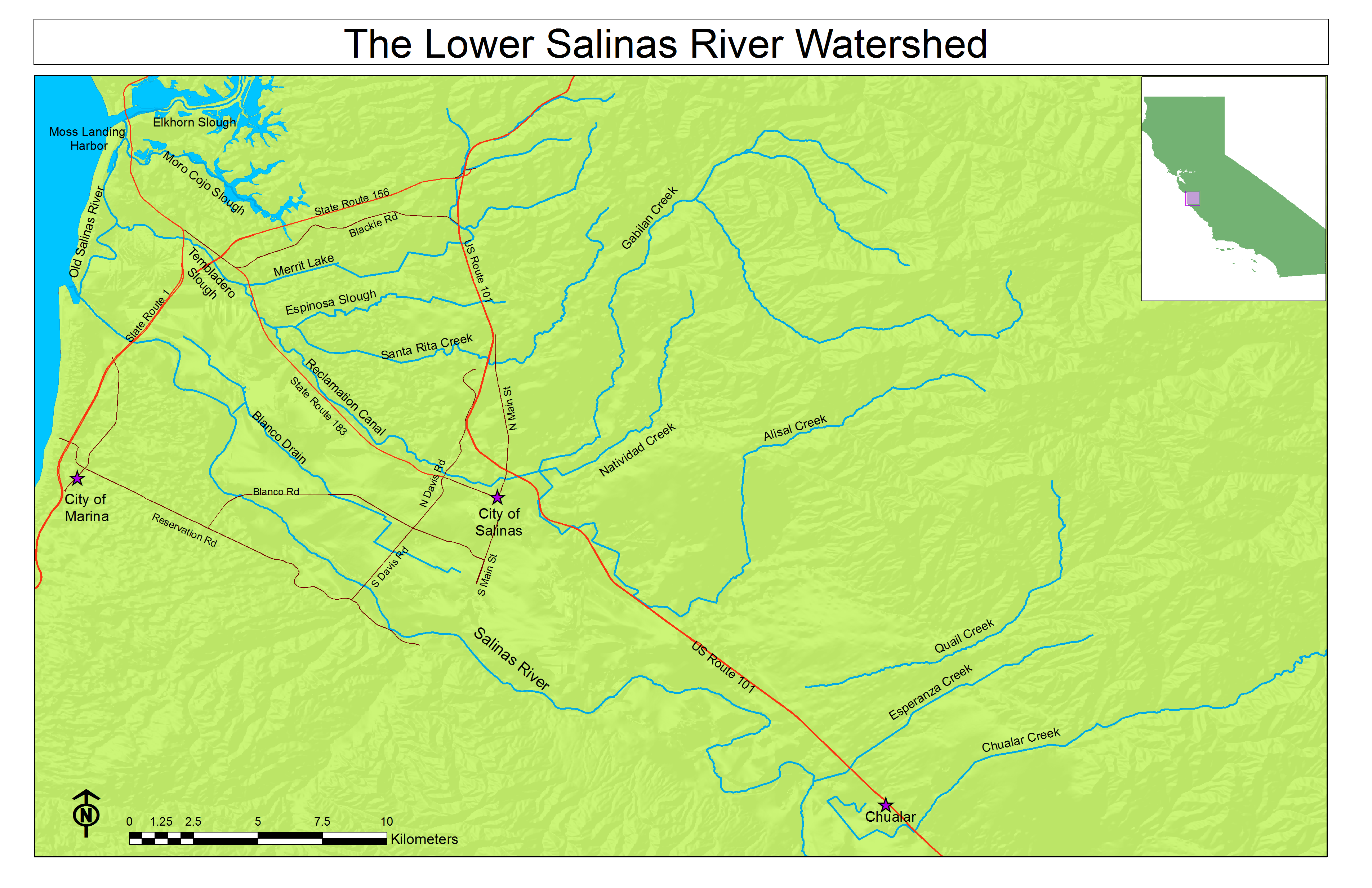
| 23:10, 9 April 2011 | Lower Salinas River Watershed.pdf (file) | 4.39 MB | Gabrielaa | 1 | ||
| 23:27, 9 April 2011 | Lower Salinas River Watershed.png (file) |  |
1.33 MB | Gabrielaa | Reverted to version as of 06:23, 10 April 2011 | 6 |
| 14:30, 12 April 2011 | Image-Lower Salinas River Watershed.pdf (file) | 4.39 MB | Gabrielaa | 1 | ||
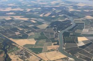
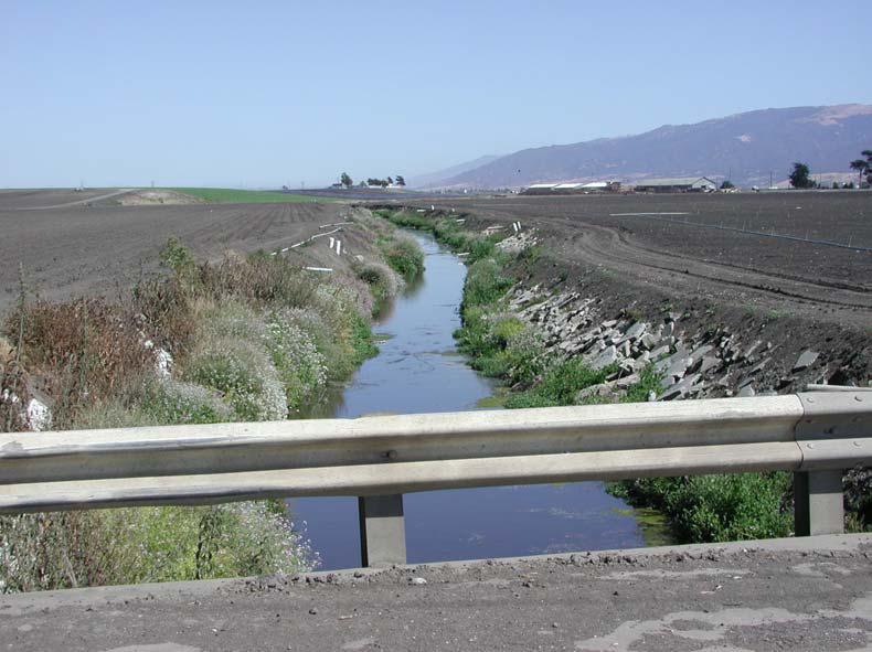
| 15:09, 12 April 2011 | Salinas Reclamation Canal.JPG (file) |  |
984 KB | Gabrielaa | 1 | |
| 15:19, 12 April 2011 | 2002 - TMDL for Nutrients San Diego Creek and Newport Bay.pdf (file) | 78 KB | Rogera | 1 | ||
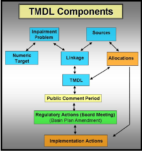
| 16:20, 12 April 2011 | TMDLGraphic.png (file) |  |
141 KB | Michelel | 1 | |
| 19:30, 28 March 2012 | 2009 region3 map.pdf (file) | 336 KB | Gwenm | 1 | ||
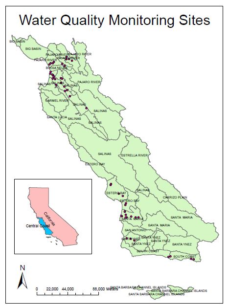
| 19:49, 28 March 2012 | 2009 region3 map.JPG (file) |  |
52 KB | Gwenm | map of Central Coast Preservation Inc sample location | 1 |
First page |
Previous page |
Next page |
Last page |