File list
From CCoWS Wiki
This special page shows all uploaded files.
| Date | Thumbnail | Size | User | Description | Versions | |
|---|---|---|---|---|---|---|
| 15:19, 12 April 2011 | 2002 - TMDL for Nutrients San Diego Creek and Newport Bay.pdf (file) | 78 KB | Rogera | 1 | ||
| 16:46, 7 April 2011 | 2003 - Santa Clara River Nitrogen TMDL.pdf (file) | 725 KB | Rogera | EPA Approved Santa Clara River Nitrogen TMDL | 1 | |
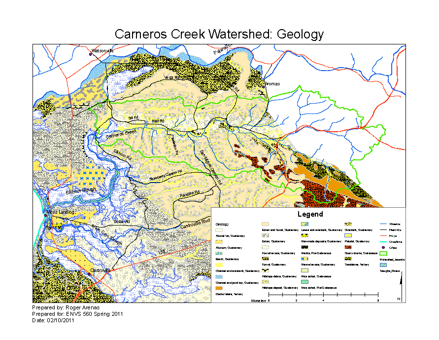
| 16:46, 15 February 2011 | CarnerosBaselineGeology.png (file) |  |
123 KB | Rogera | 4 | |
| 16:45, 15 February 2011 | CarnerosWatershed Geology.pdf (file) | 3.05 MB | Rogera | 3 | ||
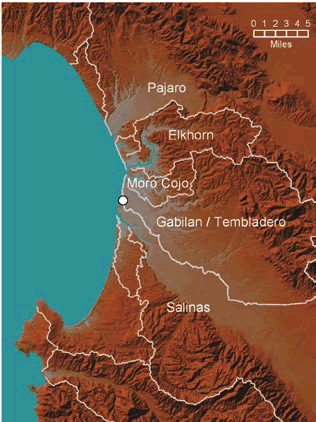
| 08:48, 7 February 2011 | Elkhorn Slough Watersheds.jpg (file) |  |
91 KB | Rogera | Map of watersheds surrounding the Elkhorn Slough estuary (map adapted from CSUMB 2007). The white dot on the map indicates the area where Salinas River waters intermittently enter the Old Salinas River Channel and Elkhorn Slough. Copied from: [http://www | 1 |
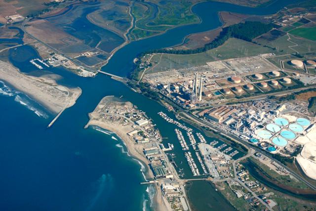
| 16:17, 10 February 2011 | Moss Landing Harbor.jpg (file) |  |
57 KB | Rogera | Ariel view of Moss Landing Harbor with Elkhorn Slough in the background. Copied from [https://eportal.usace.army.mil/sites/DVL/DVL%20Images/Forms/DispForm.aspx?ID=2573 USACE Digital Visual Library] | 1 |
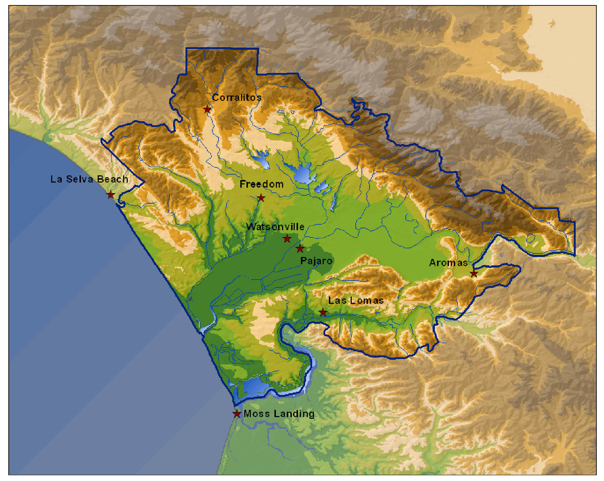
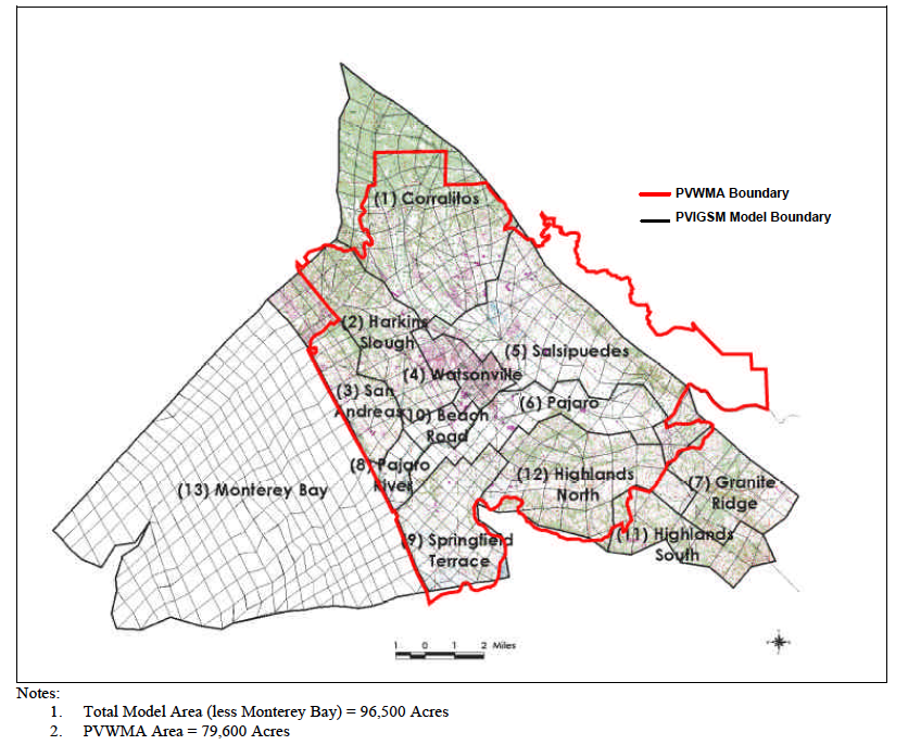
| 14:29, 8 February 2011 | Pajaro Valley Basemap.jpg (file) |  |
569 KB | Rogera | Overview of Pajaro Valley boundaries. Copied from [http://www.pvwma.dst.ca.us/# PVWMA] | 1 |
| 19:20, 1 February 2011 | Screen shot 2011-02-01 at 6.19.17 PM.png (file) |  |
447 KB | Rogera | Pajaro Valley Water Management Agency Service Area | 1 |
| 20:10, 1 February 2011 | Screen shot 2011-02-01 at 7.09.29 PM.png (file) |  |
207 KB | Rogera | Groundwater levels in Pajaro Valley | 1 |