Difference between revisions of "Carneros Watershed: Slope"
From CCoWS Wiki
(→Processing Steps) |
|||
| Line 14: | Line 14: | ||
# Spatial Analyst Toolbar -> Surface Analysis -> Slope | # Spatial Analyst Toolbar -> Surface Analysis -> Slope | ||
| − | # | + | # Input Surface: The DEM you want to calculate slope from (DEM should be projected so that x,y measurement units match the vertical measurement unit. If elevation is measured in meters, the DEM should be in UTM.) |
| + | # Output Measurement: Slope will be measured in Degrees or Percent | ||
| + | # Z Factor: The Z-factor will be 1 if the DEM was projected so the x, y units match the z unit. If the x,y units are different than the z unit, the z factor can be used to apply a unit conversion to all original elevation (z) values. | ||
| + | # Output Cell Size: Default value automatically used the input cell size. | ||
| + | # Output Raster: name and location of slope raster to be created. | ||
# Modify colors and category breaks as needed | # Modify colors and category breaks as needed | ||
Revision as of 15:53, 9 February 2011

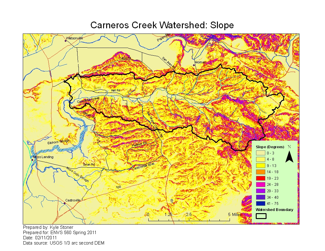
Metadata
- Original source of data: See Carneros Creek Watershed: Map of Elevation
- Data analysis: ArcMap
- Map produced by: Kyle Stoner
- Coordinate system: UTM Zone 10
- Datum: NAD 83
Processing Steps
- Spatial Analyst Toolbar -> Surface Analysis -> Slope
- Input Surface: The DEM you want to calculate slope from (DEM should be projected so that x,y measurement units match the vertical measurement unit. If elevation is measured in meters, the DEM should be in UTM.)
- Output Measurement: Slope will be measured in Degrees or Percent
- Z Factor: The Z-factor will be 1 if the DEM was projected so the x, y units match the z unit. If the x,y units are different than the z unit, the z factor can be used to apply a unit conversion to all original elevation (z) values.
- Output Cell Size: Default value automatically used the input cell size.
- Output Raster: name and location of slope raster to be created.
- Modify colors and category breaks as needed