File list
From CCoWS Wiki
This special page shows all uploaded files.
| Date | Thumbnail | Size | User | Description | Versions | |
|---|---|---|---|---|---|---|
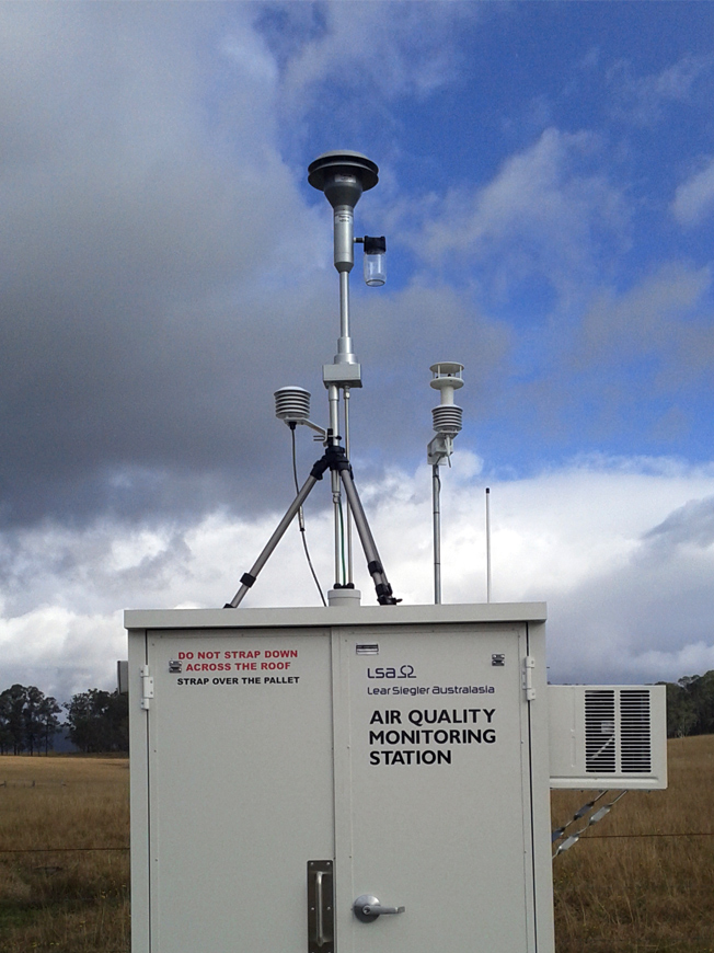
| 21:33, 6 April 2020 | Bayarea monitoring station.jpg (file) |  |
294 KB | EricW | Air Monitoring station in the bay area | 1 |
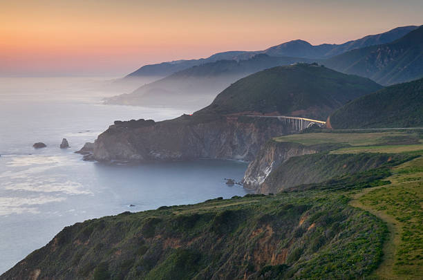
| 13:43, 18 March 2021 | BigSur.jpg (file) |  |
35 KB | IsaacN | Photo of the Big Sur Coastline. Photo from https://www.gettyimages.com/photos/big-sur?phrase=big%20sur&sort=mostpopular | 1 |
| 01:23, 29 March 2012 | Biostim 2 TMDL2012.png (file) |  |
412 KB | Scottb | Photographic documentation of biostimulation by nutrient loading in various waterways of the Lower Salinas Valley Watershed. From CCWQRCB 2012 draft TMDL nutrient report | 1 |
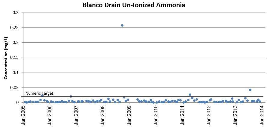
| 09:58, 11 April 2016 | Blanco Drain Ammonia.png (file) |  |
45 KB | Kaitlync | 2 | |
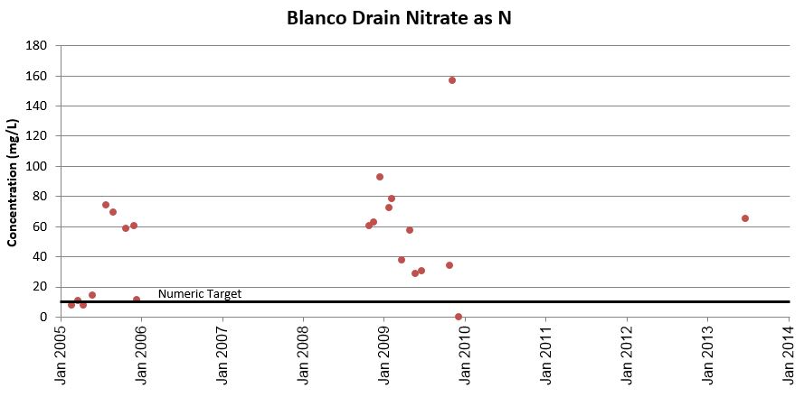
| 09:54, 11 April 2016 | Blanco Drain Nitrate.png (file) |  |
47 KB | Kaitlync | 2 | |
| 13:32, 29 March 2018 | Boards.jpg (file) |  |
122 KB | ArevMarkarian | http://ucnfanews.ucanr.edu/Articles/Feature_Stories/_New__Ag_Waivers_from_two_regional_water_quality_control_boards/ | 1 |
| 19:53, 26 March 2019 | Bullfrog.jpg (file) |  |
128 KB | AndrewC | 1 | |
| 13:59, 11 April 2017 | CACoastalTrailLogo.jpg (file) |  |
72 KB | Cynthiag | 1 | |
| 13:38, 11 April 2017 | CADeptP&R.png (file) |  |
47 KB | Cynthiag | 1 | |
| 19:14, 3 April 2019 | CASGEM BasinPrioritization Statewide.jpg (file) |  |
567 KB | MichaelG | SGMA aquifer categories | 1 |
| 15:33, 24 March 2014 | CCoWS Wiki.jpg (file) |  |
11 KB | Fred | 1 | |
| 00:00, 4 March 2009 | CDEC Precip PNR PoncainoRidge.xlsx (file) | 1.06 MB | Fred | 1 | ||
| 15:08, 1 April 2017 | CDFW-Logo-228x300.jpg (file) | 104 KB | Mattr | 1 | ||
| 12:28, 31 March 2012 | CEMAR Salinas Watershed.pdf (file) | 1.45 MB | Shelleyp | 1 | ||
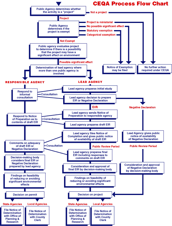
| 15:17, 28 March 2013 | CEQA process chart.gif (file) |  |
31 KB | Nicks | 1 | |
| 20:39, 31 March 2013 | CIP 2012-13.pdf (file) | 1.16 MB | Aimeet | 1 | ||
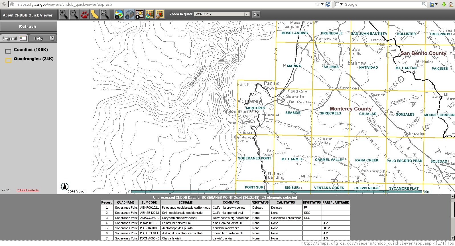
| 13:57, 8 April 2014 | CNDDB QuickViewer Screenshot.png (file) |  |
745 KB | Johni | 1 | |
| 23:31, 6 April 2017 | CNPS.gif (file) |  |
6 KB | Cynthiag | 1 | |
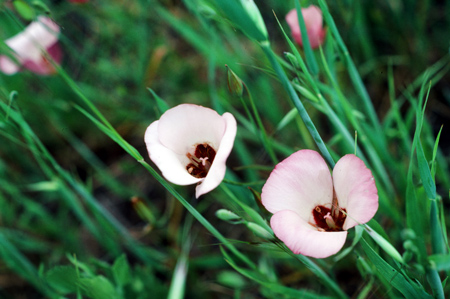
| 17:06, 7 April 2017 | CNPS Rare Flower.jpg (file) |  |
83 KB | Cynthiag | 1 | |
| 15:08, 30 March 2020 | CRAM.png (file) |  |
2.28 MB | LianaS | CRAM flowchart | 1 |
| 17:48, 2 April 2020 | CRAMlogo.png (file) |  |
57 KB | LianaS | 1 | |
| 17:55, 6 April 2016 | CRFREE Handout Feb2016.pdf (file) | 1.3 MB | Juliaf | Handout from the Big Sur Land Trust and County of Monterey Resource Mananagment Agency | 1 | |
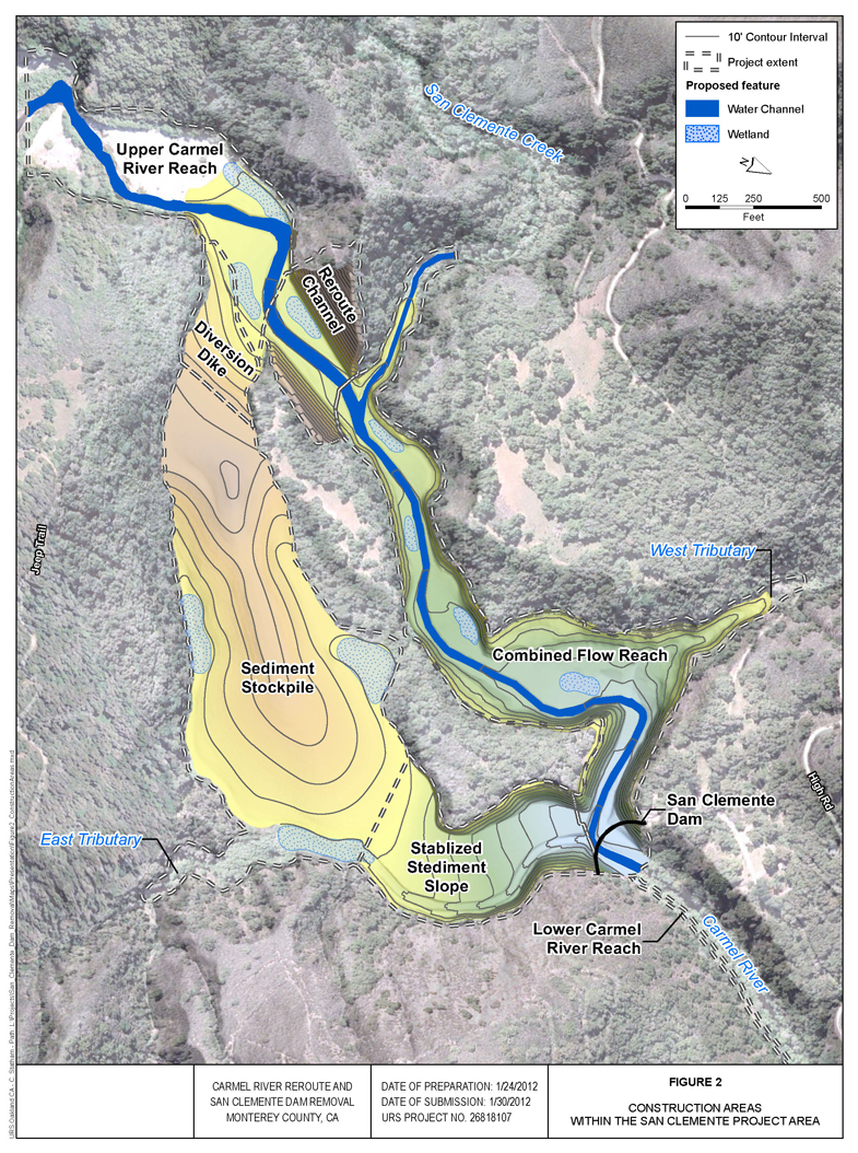
| 13:35, 29 March 2016 | CRRDR-Proposed-Project.jpg (file) |  |
883 KB | Kaitlync | Proposed layout for the Carmel River Reroute and Dam Removal (CRRDR). | 1 |
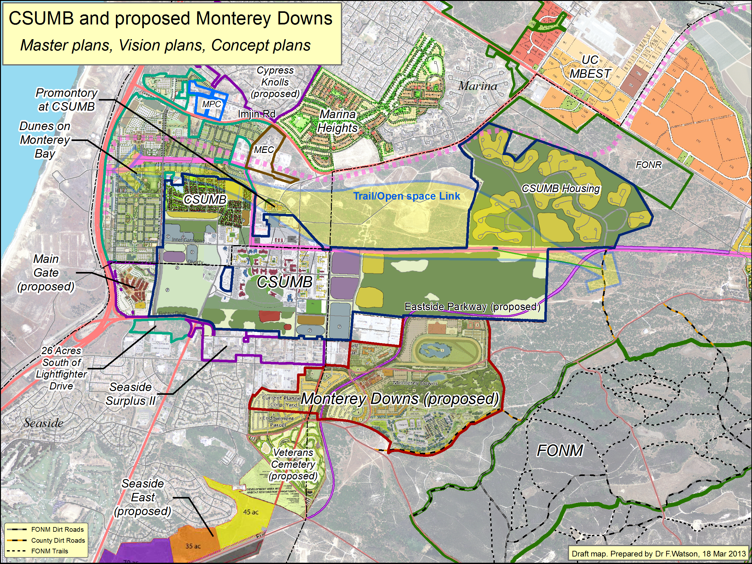
| 17:45, 3 April 2013 | CSUMB+Downs MasterPlansEtc 130318.png (file) |  |
6.58 MB | Aimeet | 1 | |
| 20:03, 6 April 2020 | CTSFortOrd.jpg (file) |  |
2.76 MB | LauraF | 1 | |
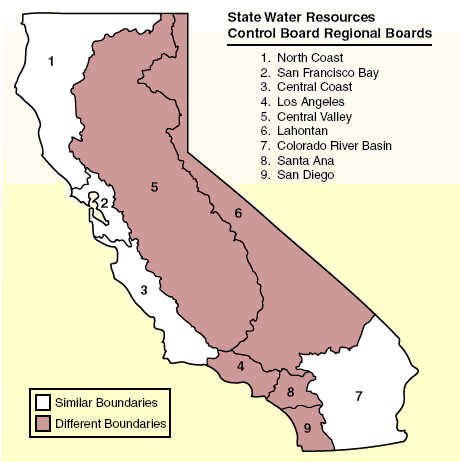
| 18:34, 5 April 2012 | Ca regions.jpg (file) |  |
122 KB | Brittanib | 1 | |
| 20:41, 30 March 2017 | Cafws logo.jpg (file) | 67 KB | Nikkii | California Fish and Widlife | 1 | |
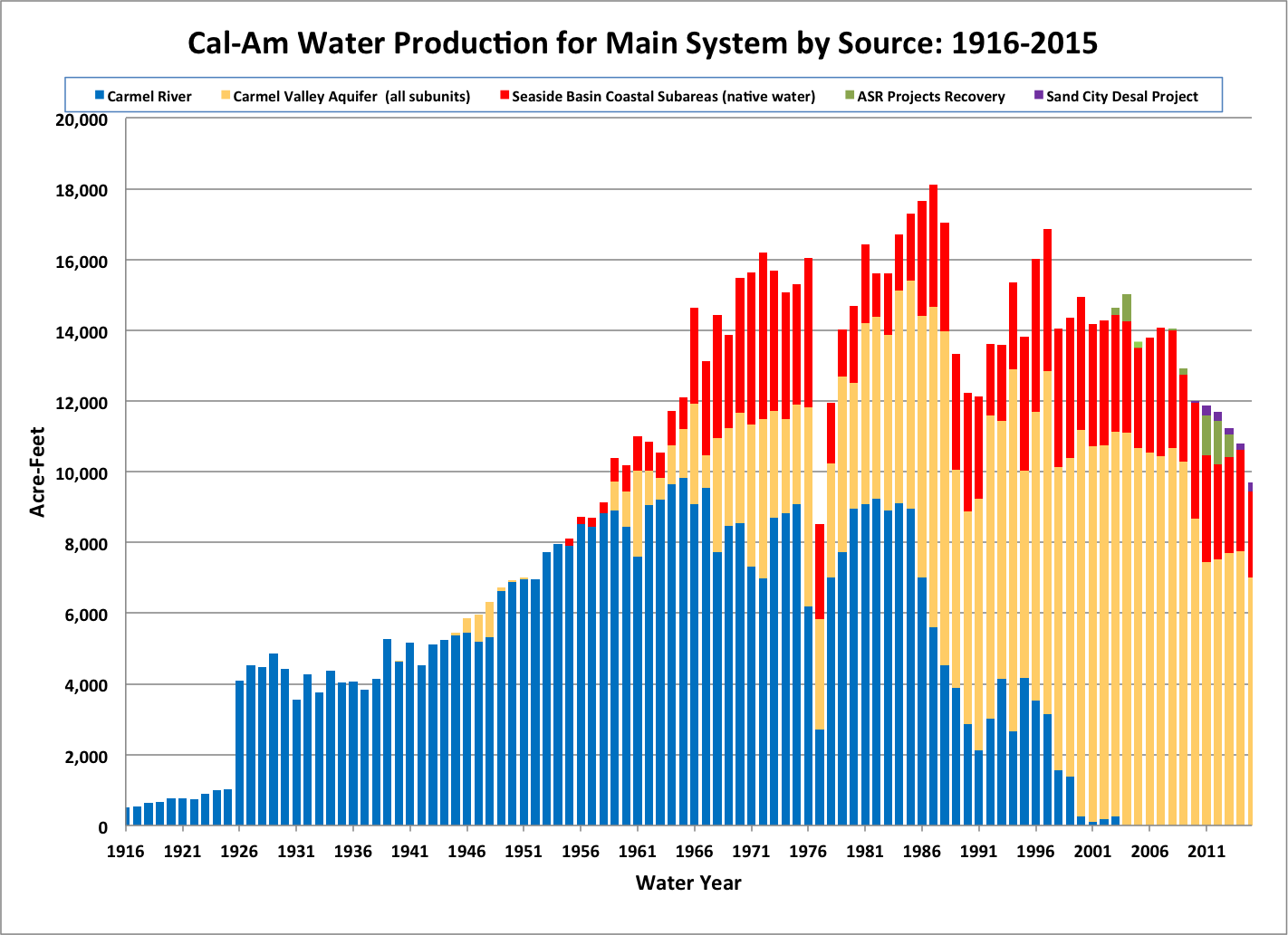
| 14:16, 10 April 2016 | CalAmWaterProduction.png (file) |  |
87 KB | Stevef | 1 | |
| 13:12, 18 March 2021 | California.png (file) |  |
2.18 MB | ConnieM | 5 | |
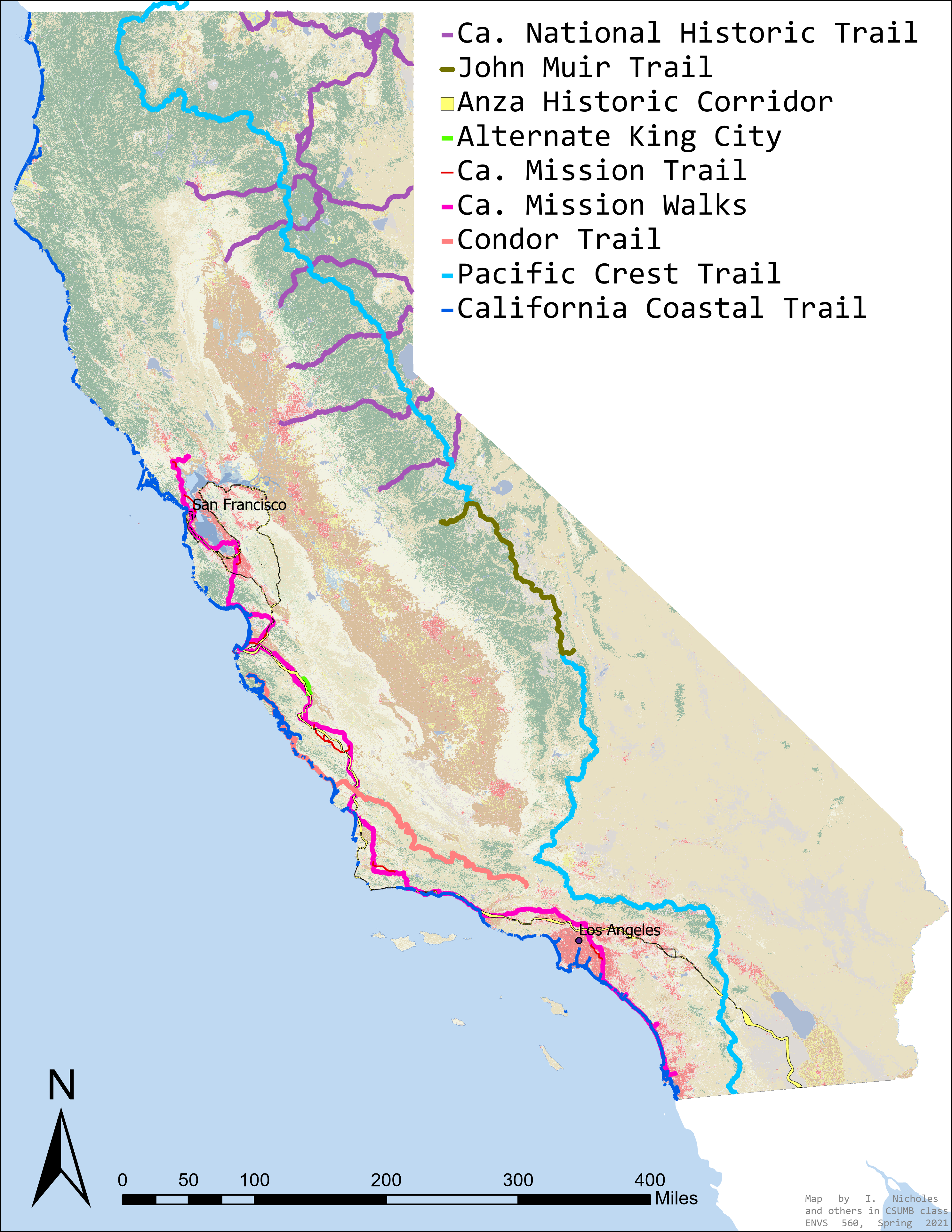
| 13:06, 18 March 2021 | CaliforniaTrails.jpg (file) |  |
2.97 MB | IsaacN | Significant Trails of California crossing through the proposed area belonging to The Range of the Condor National Heritage Area. | 1 |
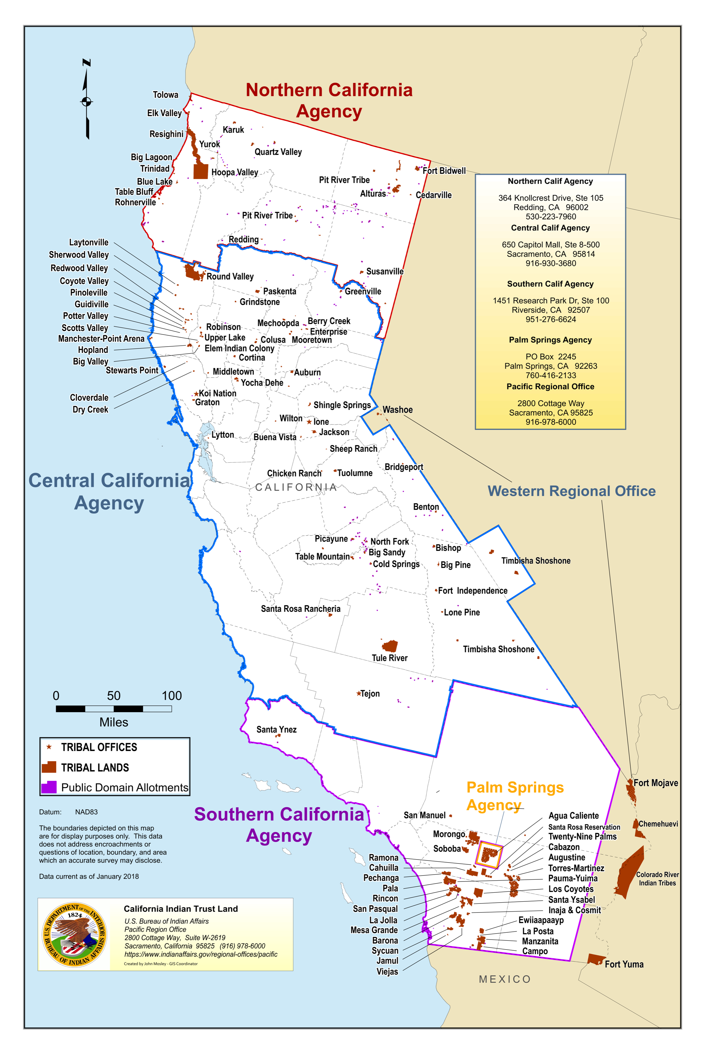
| 12:59, 18 March 2021 | California Agency Jurisdictional Map.png (file) |  |
9.18 MB | ConnieM | 1 | |
| 22:29, 2 March 2021 | California condor FWS photo.jpg (file) |  |
618 KB | AdrianG | 1 | |
| 22:23, 2 March 2021 | California condor FWS thumb.jpg (file) |  |
8 KB | AdrianG | CC_11_flying high | 1 |
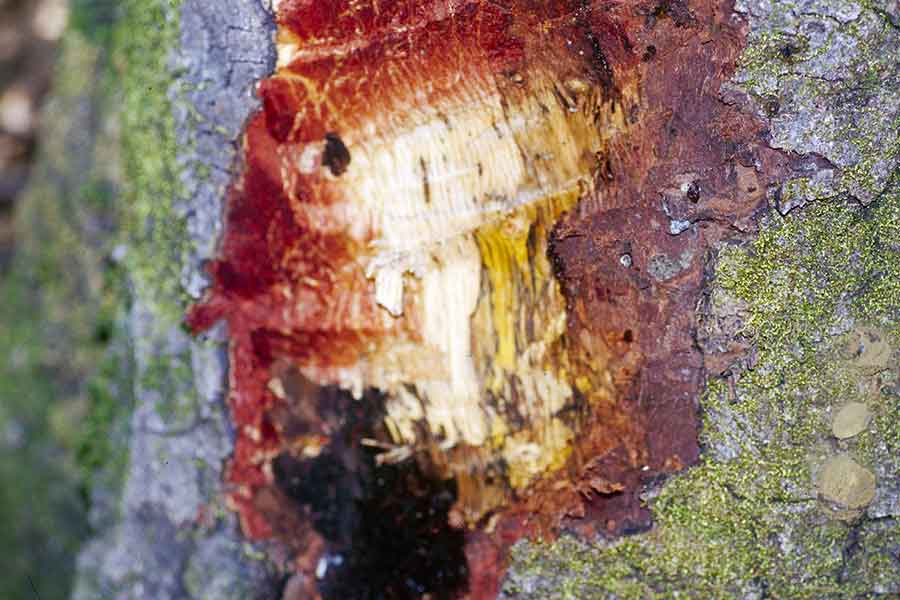
| 02:30, 30 March 2017 | Canker oak.jpg (file) |  |
56 KB | Cynthiag | 1 | |
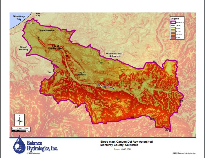
| 00:23, 5 April 2020 | CanyondelReySlopeMap.JPG (file) |  |
95 KB | RyanB | A slope map of the Canyon del Rey Watershed created by Balance Hydrologics Inc and included in the 2014 Canyon del Rey Master Drainage Plan prepared for the Monterey Peninsula Water Management District. | 2 |
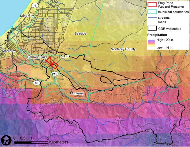
| 20:21, 6 April 2020 | CanyondelReyWatershedBoundary.JPG (file) |  |
85 KB | RyanB | 1 | |
| 12:41, 9 April 2013 | Capitola.jpg (file) |  |
6 KB | Ambers | 1 | |
| 11:52, 4 April 2013 | Capitola ca.JPG (file) |  |
72 KB | Ambers | 2 | |
| 12:43, 9 April 2013 | Capitolabeach.jpg (file) |  |
577 KB | Ambers | 1 | |
| 12:18, 9 April 2013 | Carbonera Creek.jpg (file) |  |
181 KB | Dannyw | View of Carbonera Creek where it meets Brancefore Creek near 500 Market Street in Santa Cruz (2010). | 1 |
| 08:29, 29 March 2018 | Carmel-River-Steelhead-Logo616x228.png (file) |  |
76 KB | JesseDoyle | 1 | |
| 13:48, 5 April 2016 | CarmelFREE location.png (file) |  |
356 KB | Juliaf | Image sourced from the [https://www.google.com/url?sa=i&rct=j&q=&esrc=s&source=images&cd=&ved=0ahUKEwju18HOr_jLAhUI3WMKHYpRAgoQjRwIBQ&url=http%3A%2F%2Fwww.mpwmd.net%2FMbay_IRWM%2FIRWM_library%2FLCR%2FLCRproject.pdf&bvm=bv.118817766,d.cGc&psig=AFQjCNF9c... | 1 |
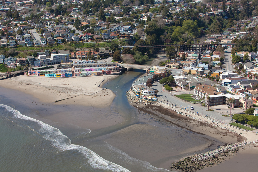
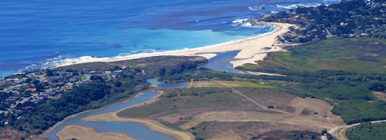
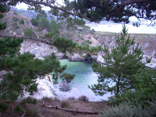
| 23:16, 7 April 2013 | CarmelRiverLagoon.jpg (file) |  |
111 KB | Elizabethg | Carmel River Lagoon. Photo courtesy of [http://www.esassoc.com/projects/carmel-river-lagoon-enhancement-project ESA]. | 1 |
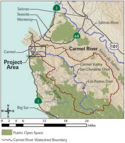
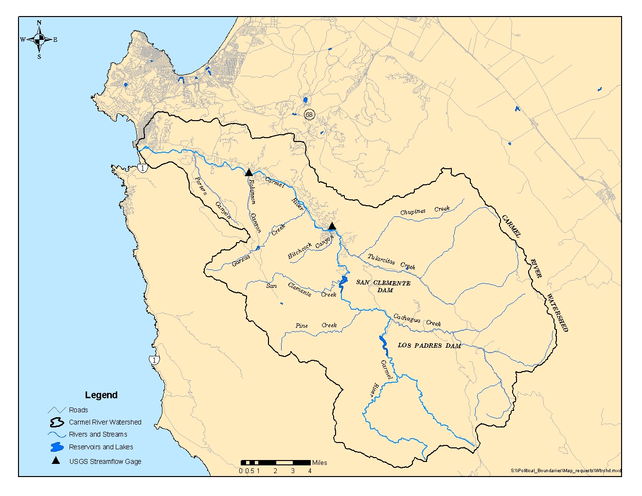
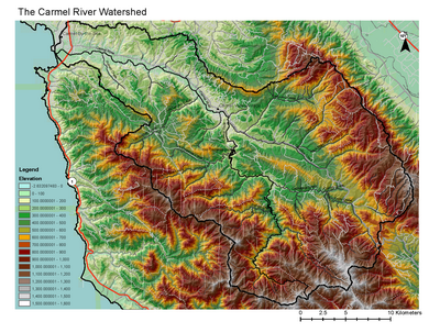
| 22:59, 7 April 2013 | CarmelRiverWatershed.jpg (file) |  |
575 KB | Elizabethg | Map of the Carmel River watershed, courtesy of MPWMD. | 1 |
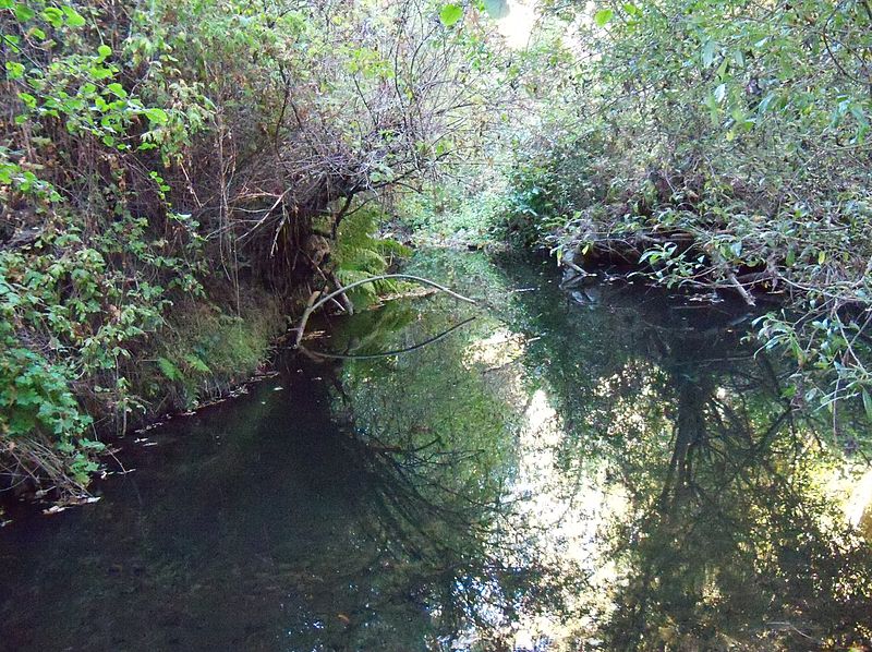
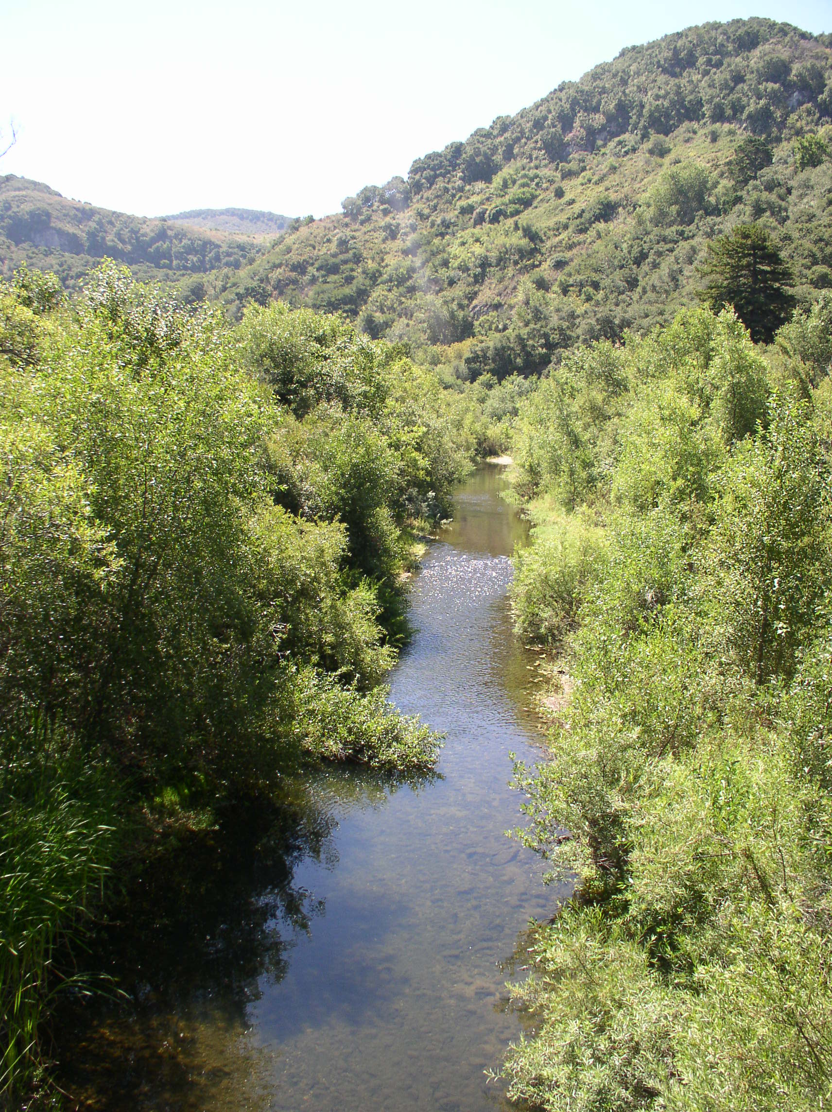
| 22:45, 7 April 2013 | CarmelRiver SchulteBridge.jpg (file) |  |
811 KB | Elizabethg | Carmel River from Schulte Bridge. Photo courtesy of Elizabeth Geisler and MPWMD. | 1 |
| 13:29, 11 April 2017 | Carmel Area State Parks Plan.jpg (file) |  |
117 KB | Cynthiag | 1 | |
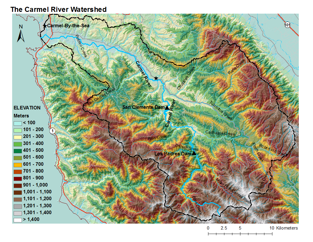
| 13:49, 11 February 2010 | Carmel BaseMap2 +Elev.pdf (file) | 3.56 MB | Mariao | 1 | ||
| 22:35, 1 February 2009 | Carmel BaseMap +Elev.pdf (file) | 1.49 MB | Fred | 1 | ||
| 13:37, 11 February 2010 | Carmel BaseMap +Elev.png (file) |  |
1.12 MB | Mariao | 2 | |
| 07:22, 2 February 2009 | Carmel BaseMap +Elev 400w.png (file) |  |
235 KB | Fred | 1 |
First page |
 Previous page |
 Next page |
Last page |