The Carmel River Watershed

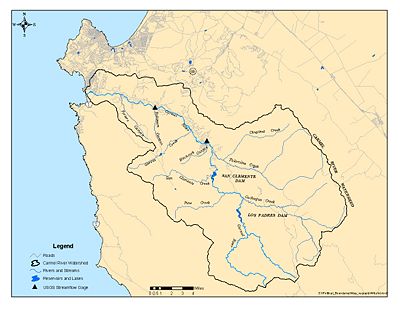
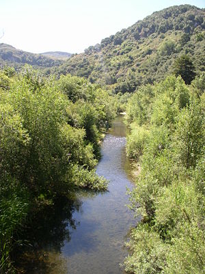
Nestled between the Sierra de Salinas and Santa Lucia Mountain Ranges on the Central California Coast, the Carmel River Watershed is composed of countless small tributaries that all drain into the Carmel River, eventually forming the Carmel River Lagoon at Carmel River beach, which periodically breaches into the Pacific Ocean.
Contents
Location
The Carmel watershed is the northernmost of a series of northwest-southeast trending valleys dissecting the rugged Santa Lucia mountains of the California Coast Ranges. The Sierra de Salinas forms the northeastern divide of the watershed and the northern terminus of the Santa Lucia Mountains forms the southwestern divide.
The watershed divides rise to approximately 1400 m (4500 ft) along the Sierra de Salinas and soar to 1500 m (4800 ft) along the Santa Lucia Range with Ventana Double Cone providing the maximum elevation of 1480 m (4853 ft). Water drains 656 km2 (256 mi2) of land, following both overland and subterranean routes to reach the coastal Carmel lagoon and eventually the Pacific Ocean. Characterization studies have divided the Carmel River Watershed into 25 subwatersheds based on natural topographic divides.
Watershed Components
Main Stem
Dams
Subwatersheds
The Carmel River Watershed incorporates a large range of annual precipitation throughout the watershed and complex geology that gives rise to a complex distribution of soil types, erosion rates, landslide potential, aquifers, recharge areas, ecosystems and human land use. For this reason, proper resource management practices may be very specific to certain watersheds rather than globally relevant. Characterization studies have divided the watershed into 25 subwatersheds based on natural topographic and hydraulic divides. Listed below are links to some of the more prominent and issue oriented subwatersheds:
- Pine Creek
- Miller Creek
- Los Padres Creek
- Rana Creek
- Mid-Carmel River
- Hitchcock Canyon
- Las Garzas Creek
- Robinson Canyon
Tributaries
Lagoon
The Carmel River Lagoon connects the Carmel River to the Pacific Ocean in winter months when flows are high. A sandbar forms and closes the river mouth during the late spring and summer months [1].
Physical Characteristics
Hydrology
Geology
Geology plays a first order role in determining the physical condition of the watershed and is a complex quilt of igneous, metamorphic and sedimentary rocks in part stitched together by faults of varying ages. The physical strength of the rocks and soils determine the erodibility, landslide potential, and ecosystem and land-use potential. Tectonically, the Carmel Watershed is carved into the Salinian Block, a piece of crust that began its existence near the Mojave desert and moved northward, dragged by the Pacific plate for the past 20 million years.
Habitat
Sensitive Species
Issues
Water Supply
Dam Removal
- San Clemente Dam Removal
Erosion
Projects
Stakeholders
- Monterey Peninsula Water Management District (MPWMD)
- California-America Water Company (Cal-Am)
- Monterey County Water Resources Agency
- Carmel River Steelhead Association (CRSA)
- ...
Timeline
Pick out key dates from this link
CSUMB Courses Relevant to the Carmel Watershed
Links
- Maps of the Carmel River Watershed
- California Central Coast Gage Locations
- Carmel River Lagoon
- San Clemente Dam
- Reservoirs
- Los Padres Reservoir
- San Clemente Reservoir
- Publications
- CSUMB-CCoWS Carmel Watershed Assessment
- EcoViz:SEP_Focus_Sites
Cite error: <ref> tags exist, but no <references/> tag was found
