File list
From CCoWS Wiki
This special page shows all uploaded files.
| Name | Thumbnail | Size | User | Description | Versions | |
|---|---|---|---|---|---|---|
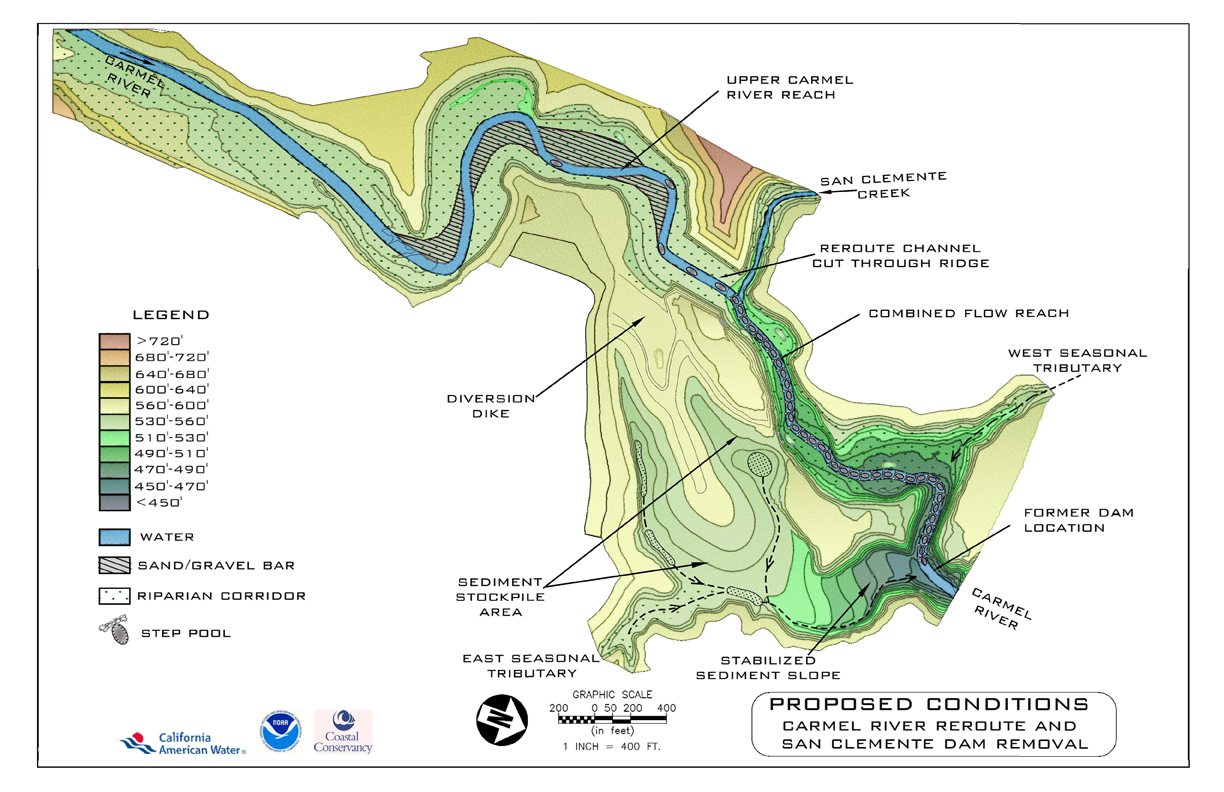
| 16:30, 28 March 2013 | Proposed SCD.jpg (file) |  |
529 KB | Sheldonl | 1 | |
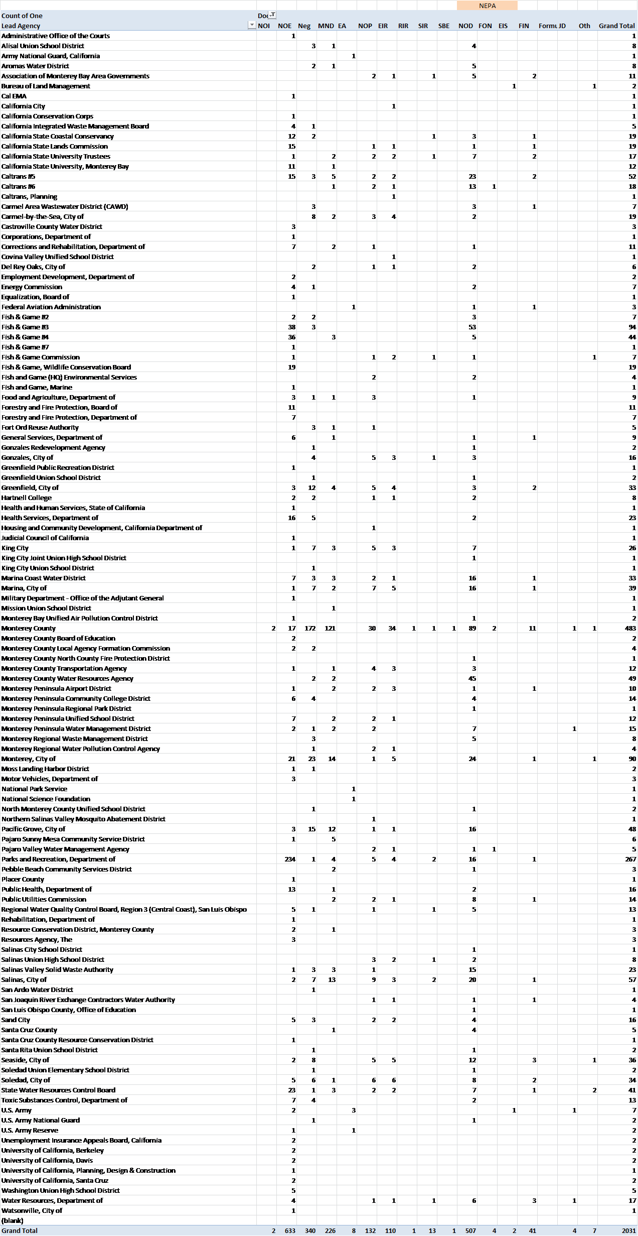
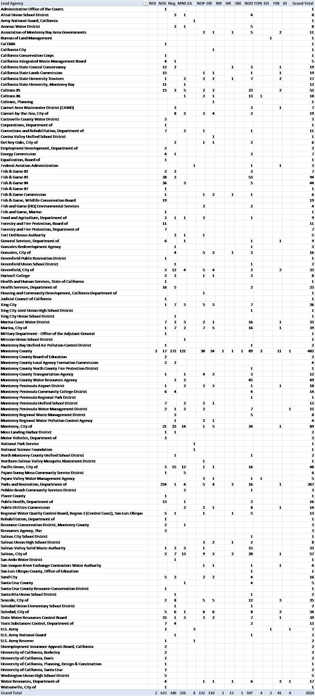
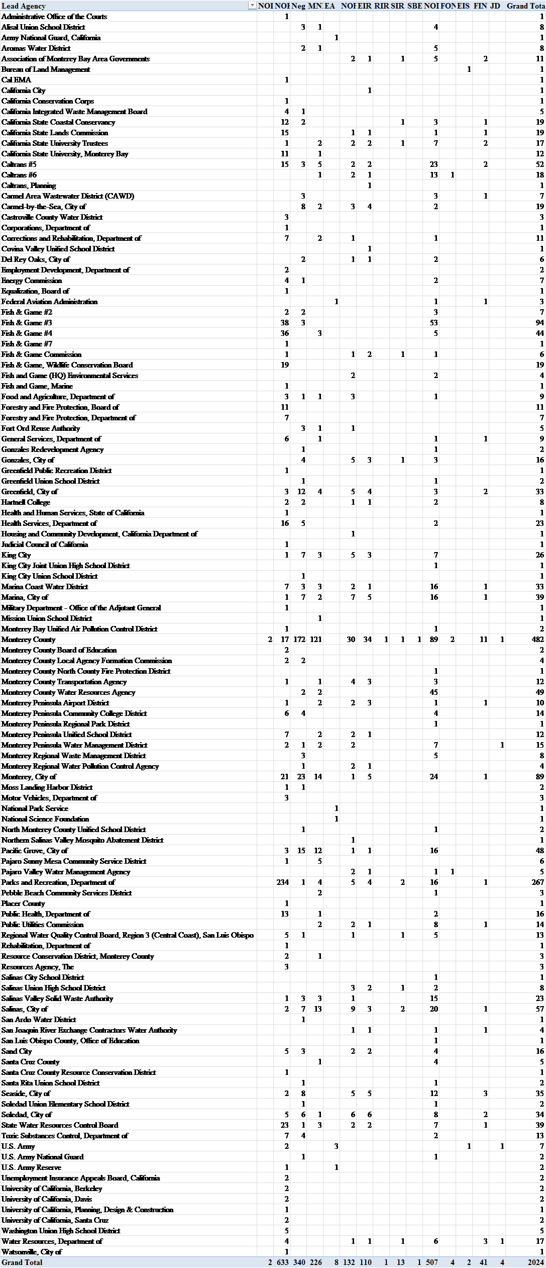
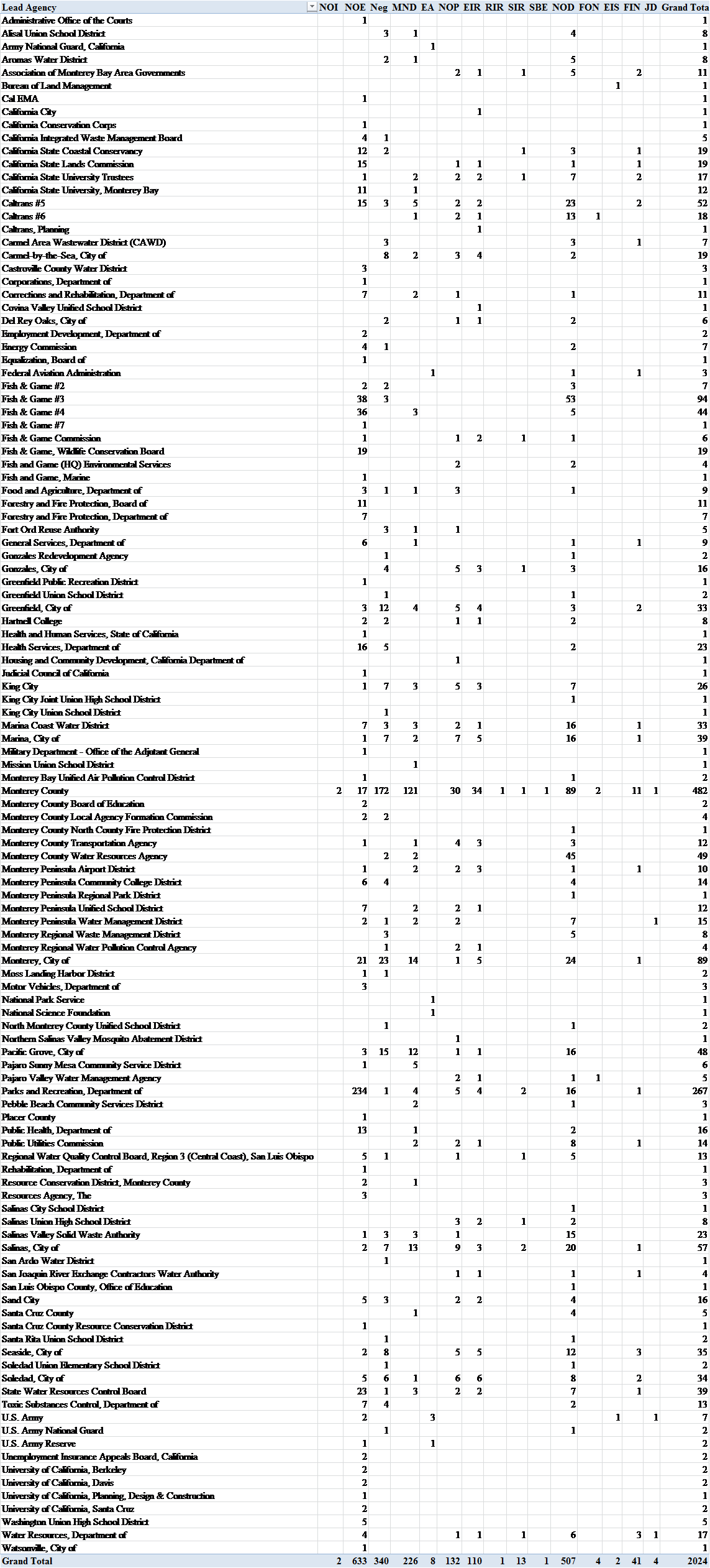
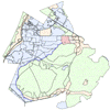
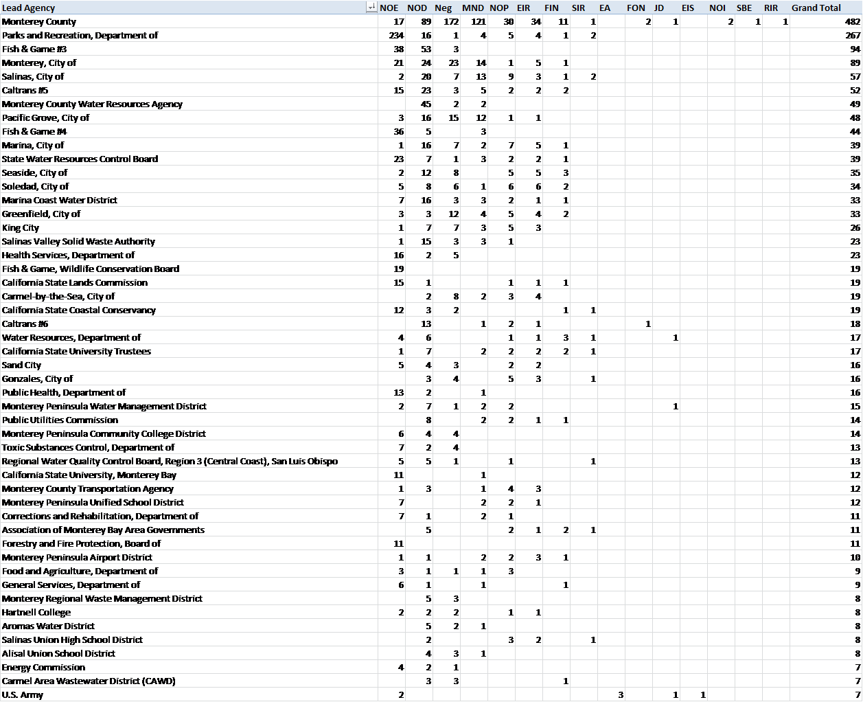
| 16:54, 28 March 2013 | Ceqaleadagencytable 130328.png (file) |  |
203 KB | Samp | CEQA Lead Agencies by Document Type (Documents headings in order of CEQA process) | 1 |
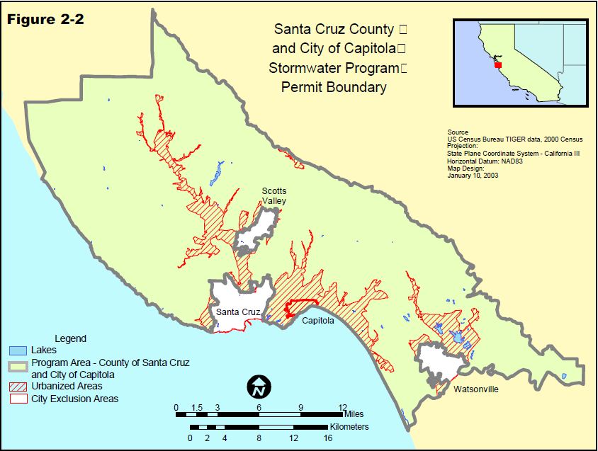
| 22:39, 28 March 2013 | SCstromwaterProgramBoundary.JPG (file) |  |
88 KB | Ambers | Santa Cruz County Storm Water Program Permit Boundary Map | 1 |
| 22:45, 28 March 2013 | SCProgramBoundary.JPG (file) |  |
88 KB | Ambers | Santa Cruz County Storm Water Program Boundary Map | 1 |
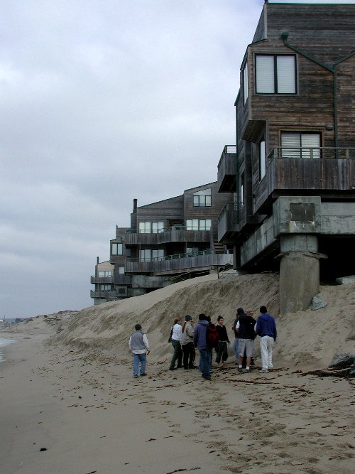
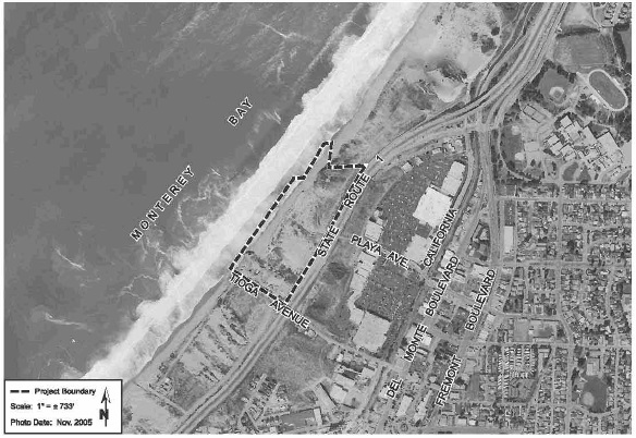
| 13:22, 31 March 2013 | Ocean Harbor House.jpg (file) |  |
76 KB | Nicks | 1 | |
| 20:39, 31 March 2013 | CIP 2012-13.pdf (file) | 1.16 MB | Aimeet | 1 | ||
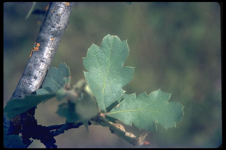
| 17:32, 1 April 2013 | Q.douglassi blueoak Brousseau.jpeg (file) |  |
42 KB | Elizabethg | Blue Oak from CalPhotos (UC Berkeley). | 1 |
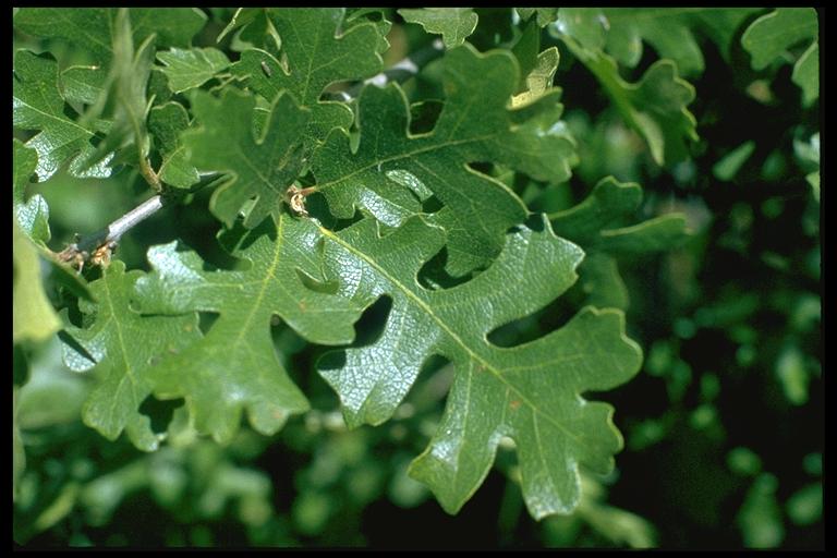
| 17:33, 1 April 2013 | Q.lobata valleyoak Brousseau.jpeg (file) |  |
59 KB | Elizabethg | Valley Oak from CalPhotos (UC Berkeley). Photo by Br. Alfred Brousseau, Saint Mary's College. | 1 |
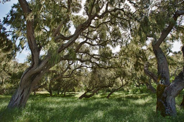
| 19:55, 1 April 2013 | Q.agrifolia coastliveoak L.Watson.jpeg (file) |  |
172 KB | Elizabethg | Coast Live Oak from CalPhotos (UC Berkeley). Photo by Lynn Watson. | 1 |
| 20:08, 1 April 2013 | Fortordoak.jpg (file) |  |
94 KB | Sheldonl | 1 | |
| 22:48, 1 April 2013 | Fort Ord BCT.jpg (file) |  |
33 KB | Sheldonl | 1 | |
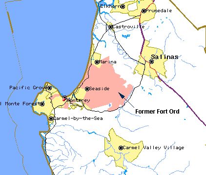
| 23:50, 1 April 2013 | Fort Ord Map.gif (file) |  |
11 KB | Sheldonl | 1 | |
| 07:51, 2 April 2013 | Wikitable3.png (file) |  |
188 KB | Samp | 1 | |
| 07:56, 2 April 2013 | Wikitable4.png (file) |  |
216 KB | Samp | 2 | |
| 08:02, 2 April 2013 | Wikitable5.png (file) |  |
248 KB | Samp | 1 | |
| 10:21, 2 April 2013 | HabMagmtPlanMap.png (file) |  |
5 KB | Aimeet | 1 | |
| 11:34, 2 April 2013 | Wikitable6.png (file) |  |
86 KB | Samp | 1 | |
| 11:37, 2 April 2013 | Wikitable abbrev.png (file) |  |
20 KB | Samp | 1 | |
| 11:39, 2 April 2013 | FONM SF Chronicle Article.pdf (file) | 115 KB | Aimeet | 1 | ||
| 12:56, 3 April 2013 | MunitionsResponseSites.pdf (file) | 66 KB | Aimeet | 1 | ||
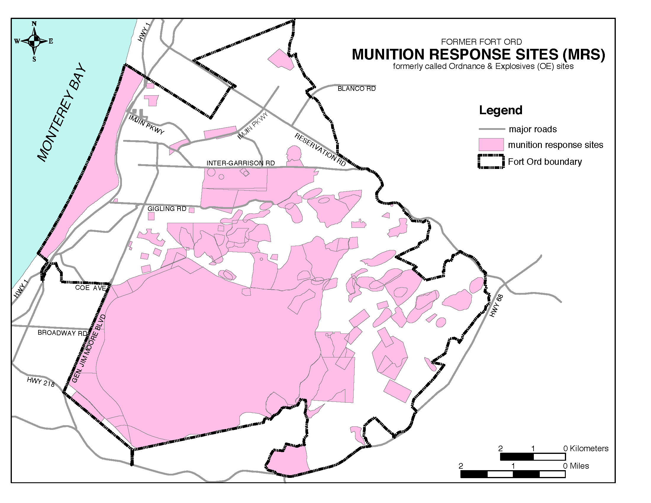
| 13:00, 3 April 2013 | MRS FtOrd.png (file) |  |
125 KB | Aimeet | 1 | |
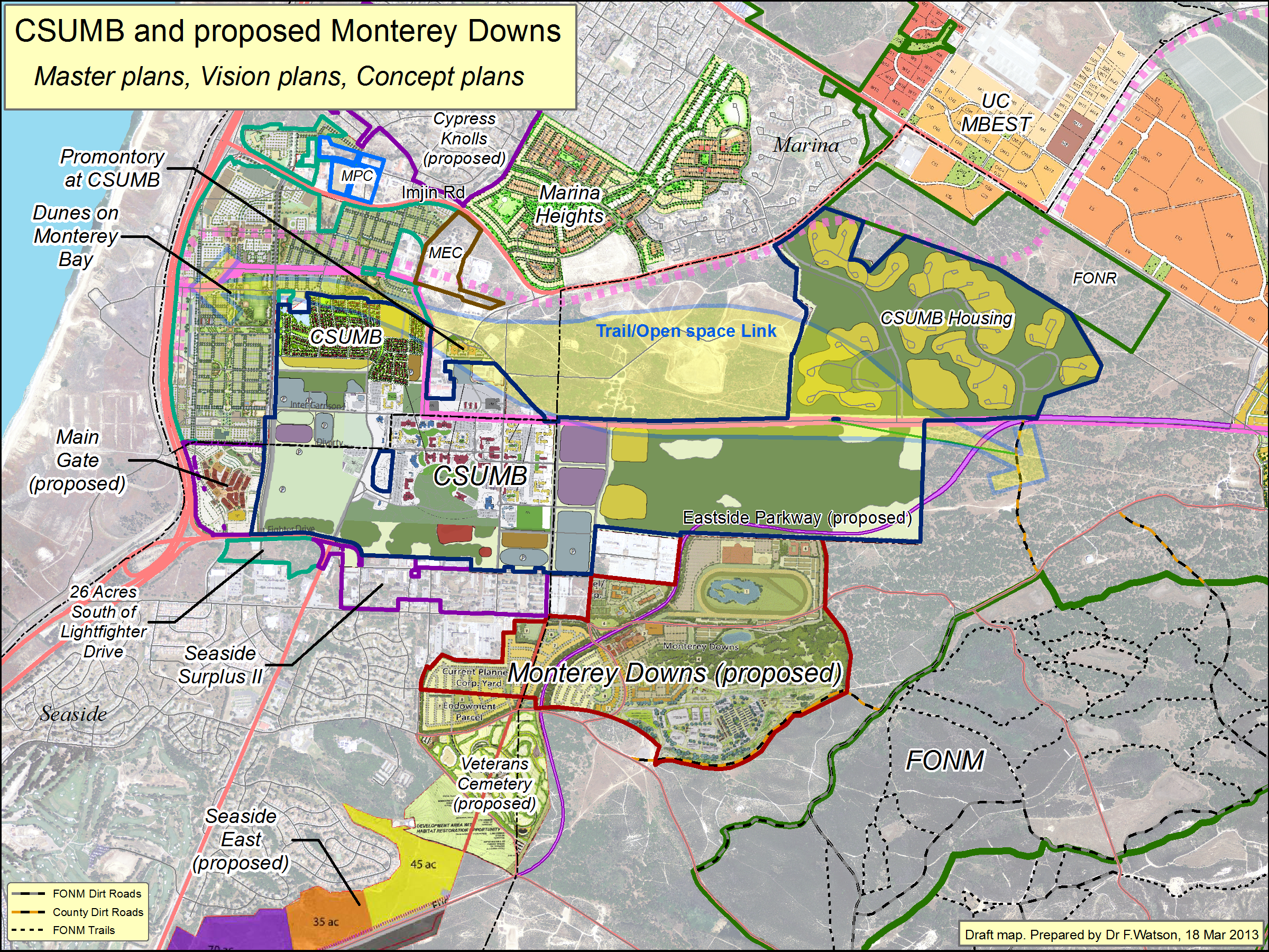
| 17:45, 3 April 2013 | CSUMB+Downs MasterPlansEtc 130318.png (file) |  |
6.58 MB | Aimeet | 1 | |
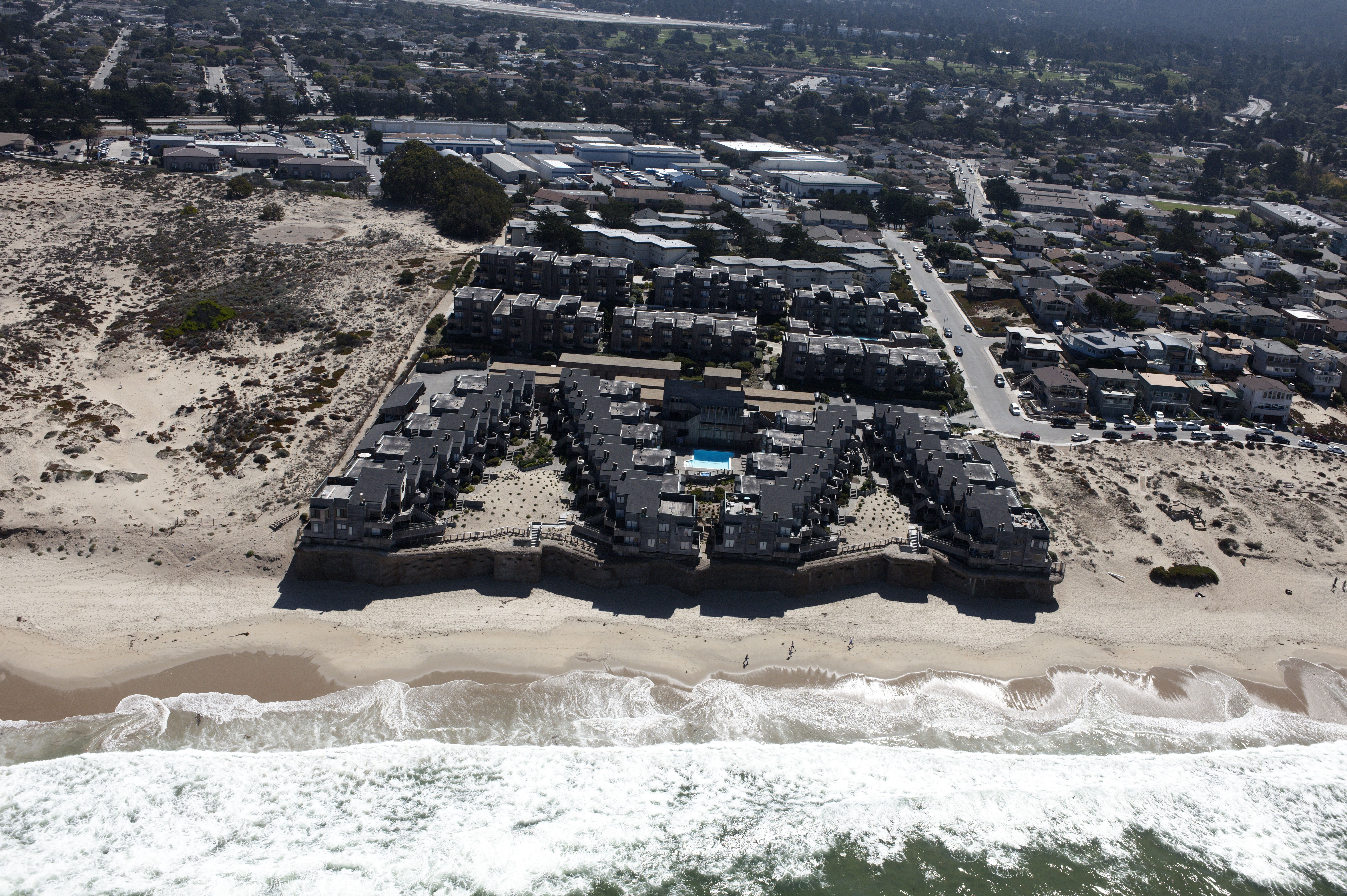
| 21:52, 3 April 2013 | Harborhouseafter.JPG (file) |  |
4.9 MB | Nicks | 1 | |
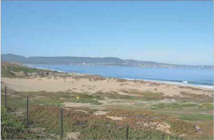
| 23:16, 3 April 2013 | Aerial2.jpg (file) |  |
108 KB | Alexs | Image 1. Aerial photo of site location. | 1 |
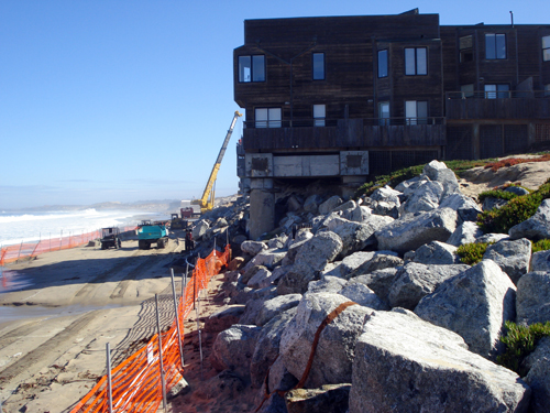
| 23:17, 3 April 2013 | Construction.jpg (file) |  |
241 KB | Nicks | 1 | |
| 23:54, 3 April 2013 | MCSite.jpg (file) |  |
154 KB | Alexs | 1 | |
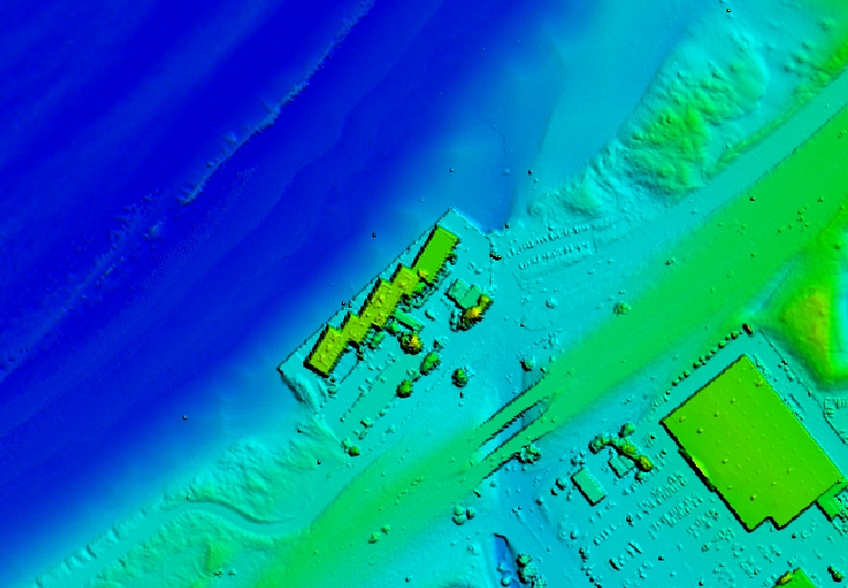
| 09:37, 4 April 2013 | Peninsula.jpg (file) |  |
307 KB | Nicks | Digital elevation model of Peninsula effect from 2003 NOAA LIDAR data http://hydro.csumb.edu/essp%20360/html/montereyseawalls.html | 1 |
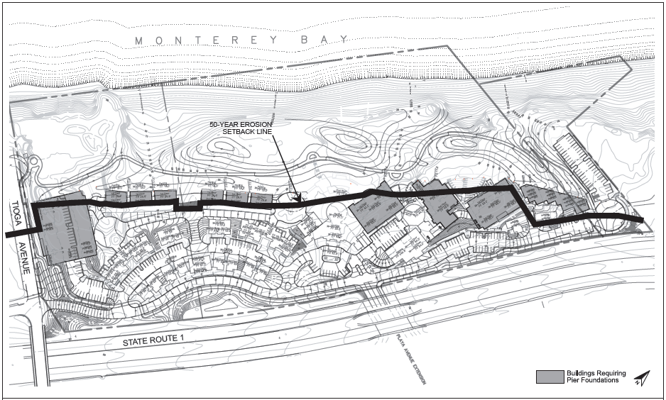
| 09:42, 4 April 2013 | 50YearSetback.jpg (file) |  |
295 KB | Alexs | 1 | |
| 10:12, 4 April 2013 | SiteLocation.jpg (file) |  |
110 KB | Alexs | 1 | |
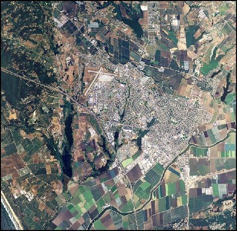
| 10:12, 4 April 2013 | Watsonville-CA-0683668.jpg (file) |  |
104 KB | Ambers | Aerial Photography Map of Watsonville | 1 |
| 10:15, 4 April 2013 | Watsonville CA.jpg (file) |  |
105 KB | Ambers | Aerial Image of Watsonville, CA | 1 |
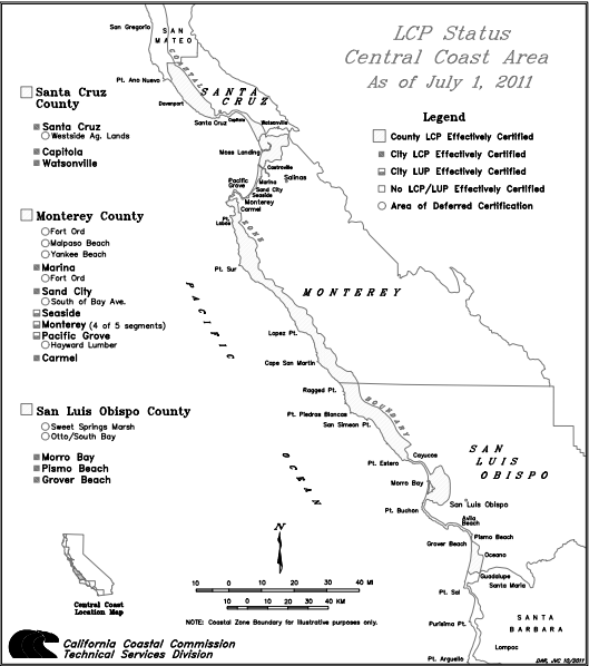
| 11:25, 4 April 2013 | CentralCoast LCP.jpg (file) |  |
80 KB | Alexs | 1 | |
| 11:28, 4 April 2013 | CentralCoast LCP.pdf (file) | 80 KB | Alexs | 1 | ||
| 11:33, 4 April 2013 | CentralCoastLCP.pdf (file) | 80 KB | Alexs | 1 | ||
| 11:38, 4 April 2013 | CentralCoastLCP.jpg (file) |  |
77 KB | Alexs | 1 | |
| 11:40, 4 April 2013 | Detension basin.jpg (file) |  |
458 KB | Julianner | 1 | |
| 11:52, 4 April 2013 | Capitola ca.JPG (file) |  |
72 KB | Ambers | 2 | |
| 12:35, 4 April 2013 | SenBoxer-Fort-Ord-support-letter-2-29-121.pdf (file) | 430 KB | Aimeet | 1 | ||
| 12:38, 4 April 2013 | DF-to-Obama-re-Ft-Ord-National-Monument-2-27-12.pdf (file) | 80 KB | Aimeet | 1 | ||
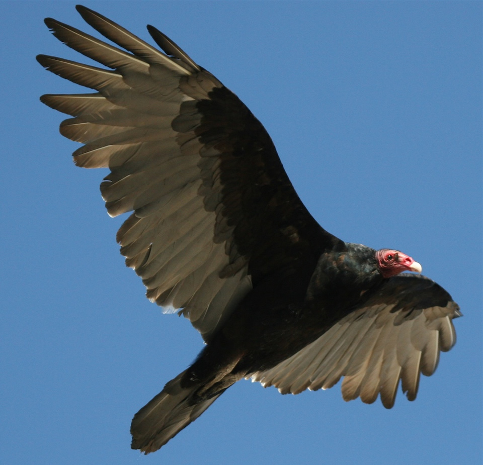
| 12:38, 4 April 2013 | TurkeyVulture.jpg (file) |  |
210 KB | Sheldonl | 1 | |
| 12:56, 4 April 2013 | Rep-Farr-Fort-Ord-Antiquities-Act 10 06 2011.pdf (file) | 880 KB | Aimeet | 1 | ||
| 13:50, 5 April 2013 | Countymapweb.jpg (file) |  |
48 KB | Aimeet | 1 | |
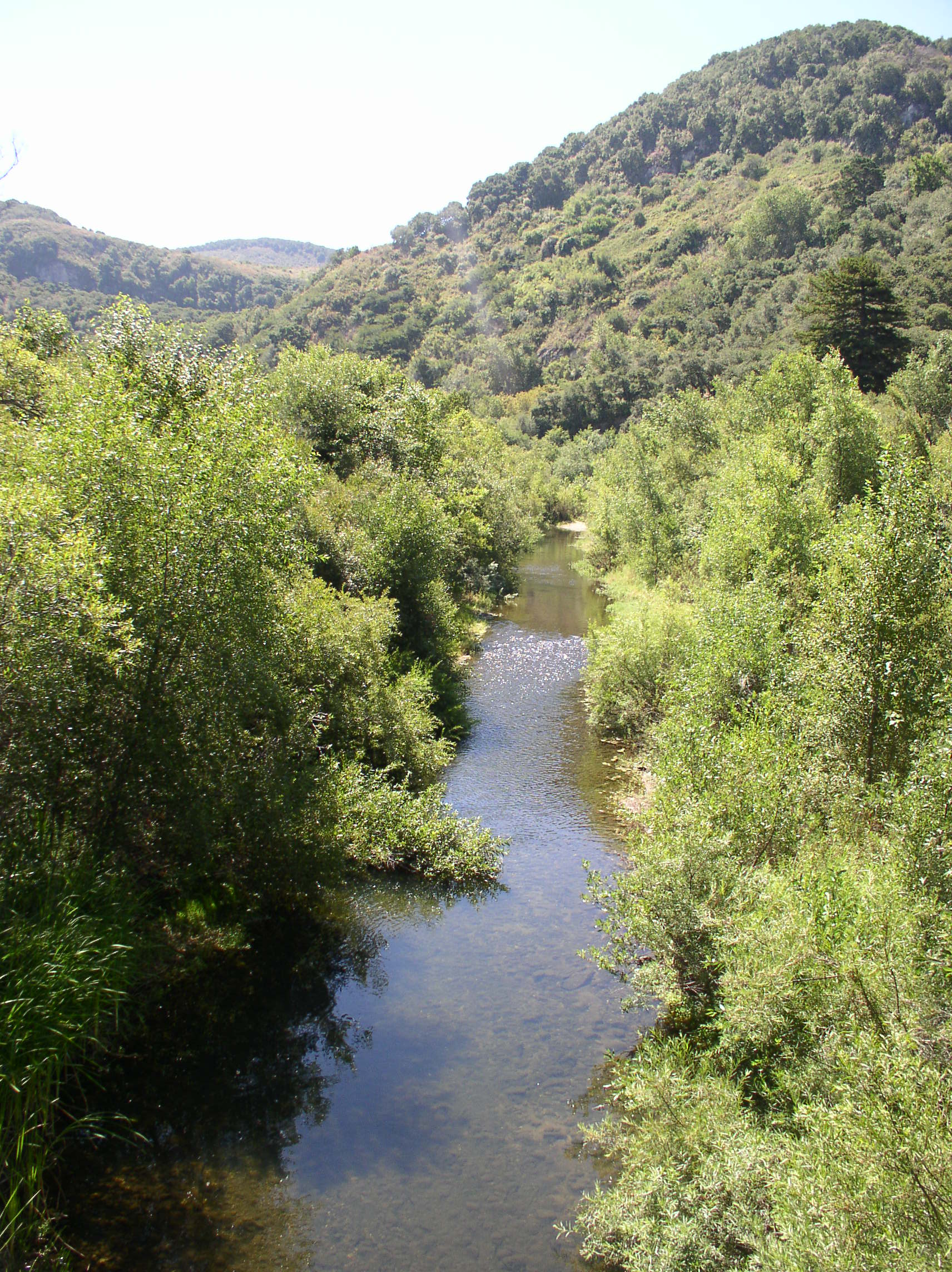
| 22:45, 7 April 2013 | CarmelRiver SchulteBridge.jpg (file) |  |
811 KB | Elizabethg | Carmel River from Schulte Bridge. Photo courtesy of Elizabeth Geisler and MPWMD. | 1 |
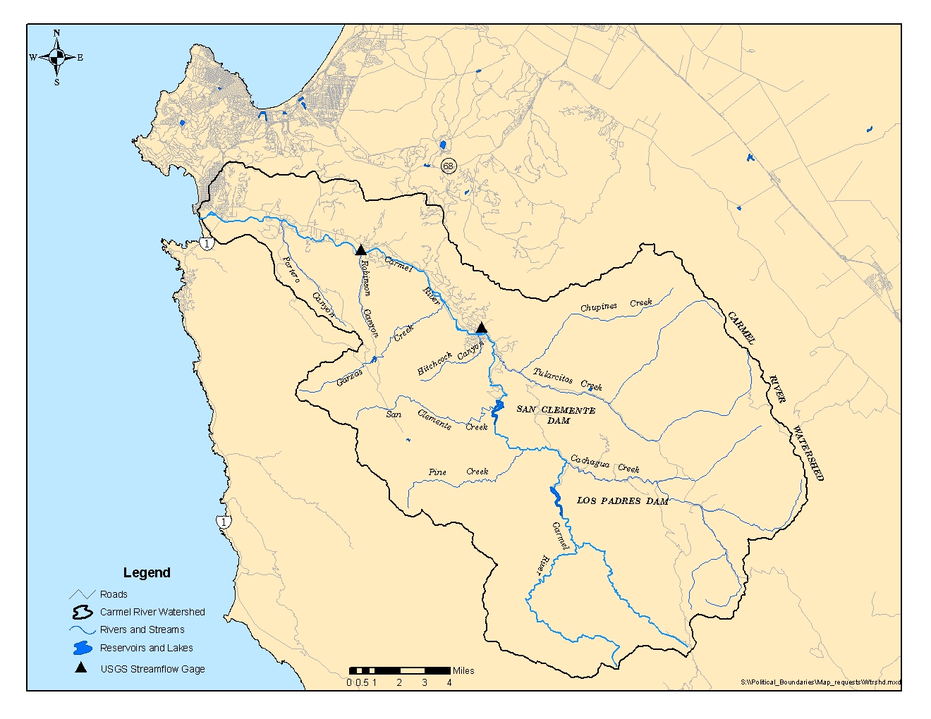
| 22:59, 7 April 2013 | CarmelRiverWatershed.jpg (file) |  |
575 KB | Elizabethg | Map of the Carmel River watershed, courtesy of MPWMD. | 1 |
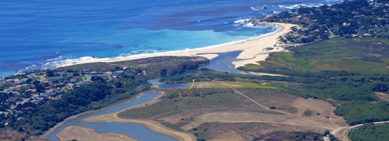
| 23:16, 7 April 2013 | CarmelRiverLagoon.jpg (file) |  |
111 KB | Elizabethg | Carmel River Lagoon. Photo courtesy of [http://www.esassoc.com/projects/carmel-river-lagoon-enhancement-project ESA]. | 1 |
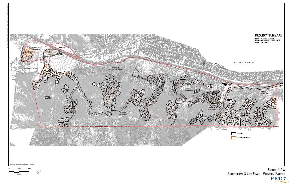
| 09:18, 9 April 2013 | Ferrini alt3.JPG (file) |  |
124 KB | Samp | 1 | |
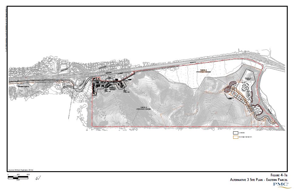
| 09:26, 9 April 2013 | Ferrini alt3E.JPG (file) |  |
89 KB | Samp | 1 | |
| 09:38, 9 April 2013 | Ferrinialt3.JPG (file) |  |
124 KB | Samp | 1 | |
| 09:38, 9 April 2013 | Ferrinialt3E.JPG (file) |  |
89 KB | Samp | 1 | |
| 10:35, 9 April 2013 | Ferrinialtimpacts.JPG (file) |  |
76 KB | Samp | 1 |
First page |
Previous page |
Next page |
Last page |